Arenales
| Arenales | ||
|---|---|---|
|
Arenales |
||
| height | 3437 m | |
| location | Chile | |
| Mountains | To the | |
| Coordinates | 47 ° 12 ′ 0 ″ S , 73 ° 28 ′ 48 ″ W | |
|
|
||
| Type | Stratovolcano | |
| Last eruption | 1979 | |
| First ascent | 1958 by the Chilean-Japanese Patagonia expedition under Germán H. Milis and Kaoru Tanaka | |
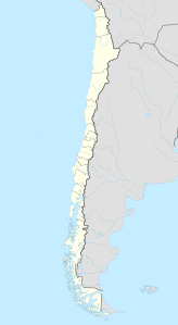
The Arenales volcano is located in the northern Patagonian ice field south-southwest of the Cerro Hudson volcano . The Arenales was only recognized as a volcano in 1963 on the occasion of an expedition led by Eric Shipton , but it was considered extinct. However, on a Landsat satellite image dated March 8, 1979, a small deposit of tephra was observed covering the ice cap on the southwest flank of the Arenales.
The first ascent of the Arenales took place in 1958 by the Chilean-Japanese Patagonia expedition, whose task it was to scientifically investigate the northern Patagonian ice field. The leadership of the expedition was in the hands of the Chilean Germán H. Milis and the Japanese Kaoru Tanaka and Masataka Takagi. Between January 20th and March 30th, three rope teams reached the summit.
Web link
- Arenales in the Global Volcanism Program of the Smithsonian Institution (English)
Individual evidence
- ↑ Alpine Club of Kobe University (Japanese and English)
- ↑ Grupo de Montaña Perros Alpinos ( Memento of the original from May 2, 2013 in the Internet Archive ) Info: The archive link has been inserted automatically and has not yet been checked. Please check the original and archive link according to the instructions and then remove this notice. (Spanish)

