Arizona State Route 89A

|
|
|---|---|
| map | |

|
|
| Basic data | |
| Overall length: | 82 mi / 132 km |
| Opening: | 1992 |
| Starting point: |
|
| End point: |
|
| Counties: |
Coconino County Yavapai County |
| Important cities: |
Sedona Cottonwood Clarkdale Jerome Prescott Valley |
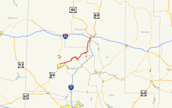
The Arizona State Route 89A (short- AZ 89A ) is a state highway in the US state of Arizona , the West-East direction is in.
The State Route begins on Interstate 17 near Flagstaff and ends near Prescott on Arizona State Route 89 . Between Flagstaff and Sedona , the road runs through Oak Creek Canyon over the Mogollon Rim . It passes the Tuzigoot National Monument before reaching Clarkdale . Until 1992, the road belonged to US Highway 89A , but this section was dissolved.
See also
Web links
Commons : Arizona State Route 89A - Collection of Pictures, Videos, and Audio Files
- Arizona Roads (English)
- AARoads (English)