Ashwood, Maury County, Tennessee
| Ashwood | ||
|---|---|---|
 Ashwood Hall, namesake of the area |
||
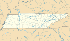
| Location in Tennessee | ||
|
|
||
| Basic data | ||
| State : | United States | |
| State : | Tennessee | |
| County : | Maury County | |
| Coordinates : | 36 ° 4 ′ N , 86 ° 28 ′ W | |
| Time zone : | Central ( UTC − 6 / −5 ) | |
| Residents : | 47,212 (as of 2014) | |
| Height : | 214 m | |
| FIPS : | 47-02240 | |
| GNIS ID : | 1304886 | |
Ashwood is an unincorporated community in Maury County , Tennessee .
geography
The area is approximately 9.5 kilometers southwest of the Columbia County's capital .
population
In 2014 the area had 47,212 inhabitants.
climate
Ashwood is located in the always humid subtropical climate zone. The average annual high temperature is 32 degrees Celsius in July and the average annual low temperature in January is 8 degrees Celsius. The average annual temperature is 18.5 degrees Celsius with high humidity. This is between 80% (in the morning) and 50% (in the afternoon) all year round.
history
The area got its name from the former mansion Ashwood Hall , founded by the Polk family. From 1841 to 1956 there was a post office there, which was also named "Ashwood". In the 18th century there was a flour mill, hemp factory, sawmill and other Polk family businesses in the area.
Individual evidence
- ^ Ashwood Population Demographics
- ↑ The Climate in Tennessee
- ^ Post Offices, Maury County, Tennessee
- ↑ St. John's Church ( Memento from February 15, 2015 in the Internet Archive )
