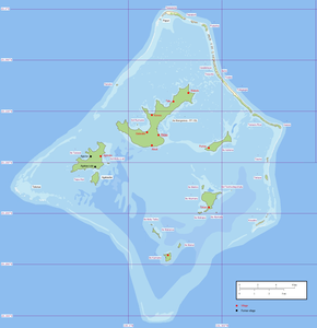
Aukena
| Aukena | ||
|---|---|---|
| Waters | Pacific Ocean | |
| Archipelago | Gambier Islands | |
| Geographical location | 23 ° 7 ′ 54 ″ S , 134 ° 54 ′ 11 ″ W | |
|
|
||
| length | 3.2 km | |
| width | 1.1 km | |
| surface | 1.35 km² | |
| Highest elevation | 198 m | |
| Residents | 31 (2002) 23 inhabitants / km² |
|
Aukena is the fourth largest of the Gambier Islands in French Polynesia . It is 3.2 km long and up to 1.1 km wide. Their area is 1.35 km². The highest point on the island is 198 m above sea level. Purirau was the historical name of the village. The settlement of the 31 inhabitants of the island is not in the same place.
The island was discovered by James Wilson in 1797. Today you can still see the remains of the Church of St. Andrew, evidence of the Christianization of the indigenous people, and some dilapidated watchtowers. The island is best known for its excellent sandy beaches and pearl farming. The unpolluted water and large deposits of plankton make it possible to breed white and black pearls here .

Aukena as seen from Mangareva
Web link
Commons : Aukena - collection of images, videos and audio files

