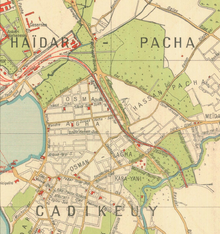
Bagdat Caddesi

The Bağdat Caddesi (German: Baghdad Street) is a well-known street in the Asian part of Istanbul . It runs about 14 km in a west-east direction through the districts of Maltepe and Kadıköy . Within Kadıköy there is an approximately six kilometers long avenue that has three lanes in only one direction and goes from Bostancı to Kızıltoprak. In terms of importance and magnificence, the Bağdat Caddesi can be understood as the Asian counterpart to the İstiklal Caddesi in the European part.
The main street leads through affluent residential areas and is surrounded in the avenue part with the old plane trees of department stores, fashion shops, restaurants with local and international offerings, cafes and bars, luxury car dealerships and banks. Most shops are open all week. In warm weather and on the weekends, the sidewalks are filled with people, while traffic jams are almost commonplace.
The wide street has always been used for illegal street races, which not infrequently resulted in fatal accidents. The police have been able to contain the street races in recent years.
The Bağdat Caddesi runs from east to west through the districts of Cevizli, Maltepe, İdealtepe, Küçükyalı, Altıntepe, Bostancı, Çatalçeşme, Suadiye, Şaşkınbakkal, Erenköy, Caddebostan, Göztepeşop and, Fenzeryışrak, Çiftzeryışrak. The busiest part with the most shops is between Suadiye and Caddebostan.
history
The forerunner of the Bagdat Caddesi was a trade and military route that connected the city of Constantinople with Anatolia. During the Ottoman period , the street was renamed to Bagdat Caddesi after Sultan Murad IV conquered Baghdad in 1638 . He had started his campaign by this road. The original course of the Bağdat Caddesi was from Üsküdar via Haydarpaşa to Kızıltoprak. The Ottomans built several drinking fountains and prayer areas for travelers along the route. Some of today's neighborhoods on Bağdat Caddesi have the Turkish word for drinking fountain Çeşme in their name (e.g. Söğütlüçeşme, Selamiçeşme and Çatalçeşme).
During Abdülhamid II's reign (1876–1909), some pashas, high state officials and merchants had luxurious wooden villas built, some of which are still standing today. Before the First World War , the street was paved with cobblestones . In the first years of the republic from 1923 the road was paved and a tram was built between Kadıköy and Bostancı.
Up until the 1960s, the area around Bağdat Caddesi was used as a summer resort for wealthier citizens from the European part of Istanbul. With the opening of the first Bosporus bridge in 1973, urbanization progressed and summer residences gave way to large residential complexes.
The Bağdat Caddesi as a meeting point
Many social events such as concerts, demonstrations and celebrations take place on Bağdat Caddesi. In this it is similar to Taksim Square on the other side of Istanbul. Every year a parade marches through here on October 29th on the national holiday. Fans of the local football club Fenerbahçe Istanbul celebrate every title of their club on Bağdat Caddesi exuberantly and magnificently.
Web links
Individual evidence
Coordinates: 40 ° 57 '12 " N , 29 ° 5' 43" E

