Bahía de Cárdenas
Coordinates: 23 ° 6 ′ N , 81 ° 9 ′ W
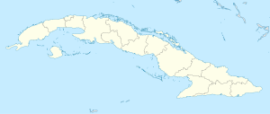
The Bahía de Cárdenas ( Spanish for: Bay of Cárdenas ) is a shallow bay on Cuba's north coast, in the province of Matanzas .
It is located on Cuba's north coast, facing the Nicolas Canal, and is bounded in the north by the Hicacos Peninsula . In the northeast lie the Cayos of the Sabana-Camagüey Archipelago , for example Cayo Cruz del Padre, Cayo Galiano and Cayo Cinco Leguas. The southeastern border is formed by the coastal wetlands and mangroves of Martí and the bay of Santa Clara . The town of Cárdenas and its port is at the southwest end. The bay has a total area of 250 km². An artificially created canal, the Kawama Canal , connects the Bay of Cardenas with the south of the city of VaraderoFlorida Street . On the south coast, the combination of dams and cayos is used for oil production.
During the Spanish-American War , the bay was the site of the Battle of Cardenas on May 11, 1898 .
Individual evidence
- ↑ Encarta (Spanish): Bahía de Cárdenas . Archived from the original on October 31, 2009. Retrieved September 18, 2008.
- ^ Gulf base: Bay of Cardenas . Archived from the original on January 30, 2009. Retrieved September 18, 2008.
- ↑ Albert A. Nofi : The Spanish-American War, 1898 . Combined Books, 1996, ISBN 0-938289-57-8 .
