Caribou – Limestone railway line
| Caribou ME-Limestone ME | ||||||||||||||||||||||||||||||||||||||||||||||||||||
|---|---|---|---|---|---|---|---|---|---|---|---|---|---|---|---|---|---|---|---|---|---|---|---|---|---|---|---|---|---|---|---|---|---|---|---|---|---|---|---|---|---|---|---|---|---|---|---|---|---|---|---|---|
| Route length: | 30 km | |||||||||||||||||||||||||||||||||||||||||||||||||||
| Gauge : | 1435 mm ( standard gauge ) | |||||||||||||||||||||||||||||||||||||||||||||||||||
| Dual track : | - | |||||||||||||||||||||||||||||||||||||||||||||||||||
| Society: | MNR | |||||||||||||||||||||||||||||||||||||||||||||||||||
|
||||||||||||||||||||||||||||||||||||||||||||||||||||
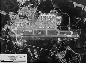
The railway Caribou-Limestone is a railway line in Maine ( United States ). It is around 30 kilometers long and connects the cities of Caribou on the Aroostook River and Limestone with the Loring Commerce Center , a former military airfield. The standard gauge line is operated today by the Maine Northern Railway exclusively in freight traffic.
history
After the opening of the main line of the Bangor and Aroostook Railroad (BAR) to Caribou and on to Van Buren, the area between the main line and the state border to Canada was not yet accessible by a railway line. Although the Canadian Pacific Railway operated on the south bank of the Aroostook River , in the absence of a bridge over the river, the places on the north bank and further north were not connected. So local investors founded the Aroostook Northern Railroad and built a railway branching off from the BAR main line in Caribou, which ended in Limestone . The standard-gauge line went into operation on December 1, 1897 - two weeks after the main line was extended to Van Buren.
The BAR ran the business from the beginning and finally acquired the line on July 1, 1901. Passenger traffic was discontinued in 1952. Freight will be held even today, primarily to connect the former Loring Air Force Base to the 1946 Limestone from a four kilometer long railway siding of the Air Force is located. After the military base was closed on September 30, 1994, the affiliation was transferred to the BAR. Today there is a housing estate and an industrial and commercial center on the former base, as well as the airfield, which is now used for civilian purposes. From 2003 the route belonged to the Montreal, Maine and Atlantic Railway , which it sold to the state of Maine in 2010. On July 1, 2011, the Maine Northern Railway took over management of the line.
Route description
The line branches off in Caribou from the BAR main line, which has now been closed between Caribou and Van Buren, so that today one can no longer speak of a branch in the actual sense. The route initially runs on the north bank of the Aroostook River in a south-easterly direction, but leaves its valley at the intersection with Murphy Road, where there used to be a stop. It turns northeast and runs in a large left-hand bend, which leads the route almost to the Canadian border, to Limestone, which is crossed in a northwest direction. After Limestone Railway Station, the section that was owned by the Air Force until 1994 begins. The route continues about four kilometers further northwest to the settlement in the former air force base.
passenger traffic
Until about 1913, two pairs of trains ran on weekdays in connection with trains on the main line. The timetable of September 28, 1913 provided for three working pairs of passenger trains running between Caribou and Limestone. Two of the trains had connections in the direction of Bangor . One of the train pairs drove as a freight train with passenger transport ("mixed train"). The travel time was between 35 and 38 minutes for the pure passenger trains. The mixed took one hour in the direction of Limestone and two hours in the opposite direction.
According to the timetable of January 8, 1934, as in 1913, three pairs of passenger trains ran every weekday. However, two of the train pairs now operated as a mixed train. The passenger trains took 30 minutes, the mixed trains between 40 and 75 minutes.
From 1939 on, only two trains per direction ran, both of which were mixed trains. From around 1940 the range was thinned to just one pair of trains, but was expanded to two again during the Second World War . From around 1948 until the end of passenger traffic in 1952, there was finally only one pair of trains.
Sources and further reading
Individual evidence
- ^ Mike Walker: SPV's comprehensive Railroad Atlas of North America. New England & Maritime Canada. Steam Powered Publishing, Faversham 1999, ISBN 1-874745-12-9 .
- ^ Official site of the Strategic Air Command
- ↑ Article on progressiverailroading.com
- ↑ Official Guide of the Railways and Steam Navigation Lines of the United States, Porto Rico, Canada, Mexico and Cuba. Issued November 1913. Bangor & Aroostook Railroad. Page 149.
- ↑ Official Guide of the Railways and Steam Navigation Lines of the United States, Porto Rico, Canada, Mexico and Cuba. Issued February 1934. Bangor & Aroostook Railroad, Table 1. Page 63.
- ^ BAR timetables from 1906 to 1953.
literature
- Jerry Angier, Herb Cleaves: Bangor & Aroostook . Flying Yankee Enterprises, Littleton MA 1986, ISBN 0-96155-743-5 .
- George H. Drury: The Historical Guide to North American Railroads. 2nd edition. Kalmbach Publishing Co., Waukesha WI 2000, ISBN 0-89024-356-5
- Robert M. Lindsell: The Rail Lines of Northern New England. Branch Line Press, Pepperell MA 2000, ISBN 0-942147-06-5 .
