Baily Lighthouse
| Baily Lighthouse Teach Solais Dhún Criofainn |
||
|---|---|---|
| Place: | Howth Head | |
| Location: | 15 kilometers east of Dublin | |
| Geographical location: | 53 ° 21 '41.6 " N , 6 ° 3' 8.8" W | |
| Fire carrier height : | 13 m | |
| Fire height : | 41 m | |
|
|
||
| Identifier : | Fl.W.15s | |
| Function: | Sea fire | |
| Construction time: | 1814 | |

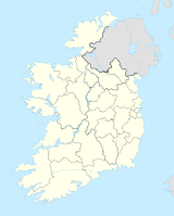
Baily Lighthouse ( Irish Teach Solais Dhún Criofainn ) is a lighthouse in Ireland . It stands about 15 km east of the Irish capital Dublin on the Howth Head peninsula and marks the southeastern end of the peninsula and at the same time the northern boundary of Dublin Bay ( Irish Cuan Bhaile Átha Cliath , German Bay of Dublin ).
Like all lighthouses and shipping signs in Ireland and Northern Ireland as well as the offshore islands and adjoining waters, it is maintained by the Commissioners of Irish Lights ( CIL , Irish Coimisinéirí Soilse na hÉireann , German "Commissioners for Irish beacons" ).
The lighthouse's original lens system , which has been in service since 1902 and was removed during the modernization in 1972, is now on display in the National Maritime Museum of Ireland (bottom left picture) .
Web links
- Baily Lighthouse at Commissioners of Irish Lights , accessed March 13, 2018.
Individual evidence
- ^ The Baily Optic , accessed March 13, 2018.


