
Balaton cycle path
| Balaton cycle path | |
|---|---|

|
|
| overall length | 204 km |
| location | Balaton (Lake Balaton) in Hungary |
| map | |
| BalatonradwegMap.jpg | |
| Course of the bike path around Lake Balaton (red marking) | |
| Places along the way | Balatonlelle - Balatonalmádi - Balatongyörök |
| Flooring | asphalted |
| Height difference | min .: 96 m, max .: 184 m |
The Balaton Cycle Path or Lake Balaton Cycle Path is a 204 kilometer long cycle path around Lake Balaton in Hungary . The Hungarian name is Balatoni körút ("Lake Balaton Loop ") or Balatoni kerékpárút ("Lake Balaton Cycle Path").
course
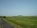
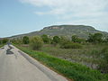
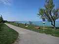
The cycle path generally runs close to the lake, but mostly not directly on the bank, because it is separated from it either by reeds, fields or a row of houses. The path on the south bank of Lake Balaton is completely flat. On the north bank, it moves further away from the lake in places, especially in the area of the municipality of Szigliget , which means that the path contains slight inclines in places, but also more viewpoints. However, the path has the highest elevation above the lake and, accordingly, the best view at the southeast corner of Lake Balaton in the area of the municipality of Balatonvilágos .
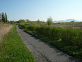
The bike path is paved throughout. It is partly designed as a cycle path through meadows or next to - mostly little-traveled - motorways, partly roads through residential areas are used for the cycle path. Long stretches of the cycle path run right next to the railway line.
The Balaton cycle path is well signposted, paved, mostly flat and also suitable for children. The recommended travel time for bike tours is from April to June and September to October. July and August are high season and it gets hot. The 200 km long circular route around the lake has existed since 2004 and organized bike tours with bike and helmet rental are offered in all larger towns. As most trains have bike compartments and you can take them on board, day tours are possible.
Signage
There is a green sign with the words "Balatoni körút". Often the nearest villages and (only on the south bank) kilometers to these are mentioned.
North bank (from west to east)

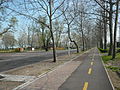
Bike path near Keszthely

Bike path at Gyenesdiás
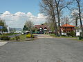
Bike path at Balatongyörök
Bike path at Balatonederics
Badacsonytördemic cycle path

Bike path at Révfülöp

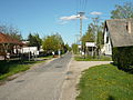
Bike path near Balatonakali

Bike path in the city of Balatonfüred

Bike path at Balatonfűzfő


South bank (from east to west)
Bike path at Balatonvilágos
Bike path near Balatonföldvár
Bike path at Balatonszemes
Bike path near Fonyód
Bike path near Balatonfenyves
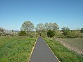
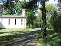
Fenékpuszta bike path


_bei_Keszthely-Fen%C3%A9kpuszta.jpg)
literature
- Kerékpártúrák Magyarországon . Frigoria Könyvkiadó Kft., Budapest 2011. ISBN 978-963-9586-24-6 . ( Hungarian , English , German )
Web links
- Balaton Cycle Route ADFC Radwelt 01-2011
- GPS track of the Balaton cycle path
- Balaton cycle path at radreise-wiki
Individual evidence
- ↑ GPS track of the Balaton cycle path 194
- ↑ Bicycle tour in Hungary: Take it easy , Die Zeit, July 23, 2010
- ↑ Travel information Balaton-Radweg ADFC Radwelt 01-2011
- ↑ Tours for a week's vacation: A new cycle path around Lake Balaton Berliner Zeitung, May 22, 2004
Coordinates: 46 ° 45 ′ 10 " N , 17 ° 20 ′ 27.7" E