Bali street
| Bali street | |
|---|---|
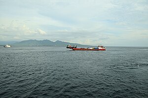
| View of Bali across the Bali Strait from Java | |
| Connects waters | Bali Sea |
| with water | Indian Ocean |
| Separates land mass | Bali |
| of land mass | Java |
| Data | |
| Geographical location | 8 ° 6 ′ S , 114 ° 26 ′ E |
| length | 100 km |
| Smallest width | 2.4 km |
| Coastal towns | Banyuwangi |
| The Bali Strait is very busy with small and medium-sized ships | |
The Bali Strait, Selat Bali in Indonesian , is a 2.4 kilometer wide strait between the Indonesian islands of Bali and Java .
A ferry connects the two islands between Banyuwangi (Ketapang port) on Java and Gilimanuk on Bali. The north coast of Bali is part of the Bali Barat National Park (founded in 1995).
Studies have been underway since the early 1990s to build a bridge over the Bali Strait, similar to the planned bridge over the Sunda Strait .
The planned Bali – Java Powerline will connect the power supply to the two islands.
Web links
Commons : Bali Street - Collection of Pictures, Videos and Audio Files


