Basirhat
| Basirhat | ||
|---|---|---|
|
|
||
| State : |
|
|
| State : | West Bengal | |
| District : | Uttar 24 Pargana | |
| Location : | 22 ° 39 ′ N , 88 ° 54 ′ E | |
| Height : | 15 m | |
| Residents : | 125,254 (2011) | |
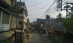
| Street scene | ||
Basirhat is a city in the Indian state of West Bengal with around 125,000 inhabitants (2011 census). It is located in the Uttar 24 Pargana district and is part of the Kolkata agglomeration .
population
The strong increase in the urban population is mainly due to the immigration of families from rural regions.
| year | 1991 | 2001 | 2011 |
| Residents | 101,409 | 113.159 | 125.254 |
Basirhat has a gender ratio of 981 women per 1000 men and thus a common surplus of men for India. The city had a literacy rate of 87.35% in 2011 (men: 90.51%, women: 84.15%). Literacy is thus far above the national average and that of West Bengal. Almost 77.6% of the population are Hindus , approx. 22.2% are Muslims and approx. 0.2% did not state any religious affiliation or practiced other religions. 8.9% of the population are children under 6 years of age.
Infrastructure
The city has a train station that connects it to Kolkata and the rest of India.
Web links
Individual evidence
- ^ Census of India 2011: Provisional Population Totals. Cities having population 1 lakh and above. (PDF file; 151 kB)
- ↑ DISTRICT CENSUS HANDBOOK NORTH TWENTY FOUR PARGANAS. Retrieved May 2, 2019 .
- ↑ 2011 census (PDF; 398 kB)
- ↑ Basirhat City Population Census 2011-2019 | West Bengal. Retrieved September 25, 2019 .

