Bathford
| Bathford | ||
|---|---|---|
|
|
||
| Basic data | ||
| status | Parish | |
| region | Bath and North East Somerset | |
| Ceremony county | Somerset | |
| Trad. county | Somerset | |
| Administrative headquarters | Bath | |
| surface | 7.28 km² | |
| population | 1,800 | |
| ONS code | ||
| Website | [1] | |
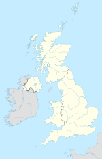
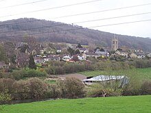
Bathford (the stress is on the second syllable) is a village 4 kilometers east of Bath , Somerset . It has about 1800 inhabitants and covers an area of 600 hectares . The village belongs to Bath and North East Somerset , a unitary authority .
geography
The village, surrounded by many natural stone walls, is conveniently located on the main road A 363, which leads to the A4, which is about 1 kilometer to the north. The road crossed the By Brook (a stream also known as Box Brook and The Weaver and Withy Brook) at Bathford Bridge. The bridge, built in the 13th or 14th century, still spans the stream today. Before, there was a ford at this point , from which the village name derives. Bathford is on the southern slope of the Avonval Valley. There are several natural stone quarries on the hills behind the village. From there you also have an excellent view over the valley and the nearby Solsbury Hill , which is also sung about in Peter Gabriel's song.
history
In the " Codex Diplomaticus Aevi Saxonici ", a historical document, a parish consisting of three so-called "tithings", so to speak manors, is mentioned on the site of today's Bathford. These are Bathford farms in the center, Shockerwick in the north and Warley (now Warleigh) in the south. Until the 17th century, the farms were run under the name "Forde", derived from the ford over the By Brook between Bathford and Bathampton . The ford was directly connected to the Roman road Fosse Way . This can already be read in a Saxon document from the 10th century, in which the manors are described. The boundaries of the former courtyards and the Fosse Way roughly correspond to today's municipal boundaries.
In the vicinity of the transition are the ruins of a Roman villa, the remains of which were found in the 17th century, a hypocaust , a Roman hot air heater . This villa is already mentioned by John Aubrey in his work "Monumenta Britannica":
“At Bathford (near the town of Bathe) in 1655, when an unusually deep drainage ditch was being dug on Mr. Skreene's property, a space 14 feet wide and 17 feet long was discovered. Their floor consisted of small different colored stones in opus tesselatum (mosaic) namely white (limestone), blue (liasse) and red (fine brick). In the middle of the room was a not very well proportioned blue bird and a kind of knot in each of the four corners. Bath Abbey owns this property and the entire homestead. There is water below the floor. The floor stands on stone pillars that are a cubit apart. Stone planks were placed on the pillars on which the opus tesselatum was placed. A little below, water leaks from the ground and many are convinced that there is a lot of water in it. The discovery led to so many people visiting the place that Mr. Skreene was compelled to cover the place again because the large crowd, especially from Bathe, destroyed his property. He didn't manage to cover the place that quickly though, so people destroyed and demolished the work before I could get there and see it. But his daughter-in-law had made the floor as tapestry embroidery. Mr. Skreene told me that there was another adjacent pristine floor. "
Near Bathford, across the river, is a large meadow known as the Horselands. According to tradition, this meadow was said to have served as a parade ground for the Roman cavalry . Later this meadow, bounded by Eastling Lane and Bradford Road (A363), was used to graze the extra horses for the stagecoach that hauled the post office up to Bathford Hill. After the carriage was down again, the horses were unhitched again and waited for the next carriage. With the older residents, the Ostling Lane is still called Horses Lane (horse lane).
Attractions
- The Old Bathford Railway Bridge was built by Isambard Kingdom Brunel as part of the old Great Western Railway .
- St, Swithun's Church, the oldest part of which dates from the 12th century, surrounds a cemetery where Admiral Lord Nelson's sister Ann was buried. However, the grave can no longer be found.
- Eleazer, (a former Mayor of Bath) grandson of Moses Pickwick of Corsham is also buried in St: Swithun's.
Neighboring towns and villages
swell
- The Bathford Village website
- James Tunstall: Rambles around Bath (1846)
- John Aubrey: Monumenta Britannica: A Miscellany of Antiquities (1982)
Web links
Coordinates: 51 ° 23'58 " N , 2 ° 18'15" W.

