Bay of Islands (Newfoundland)
| Bay of Islands | ||
|---|---|---|
| Waters | Gulf of Saint Lawrence | |
| Land mass | Newfoundland | |
| Geographical location | 49 ° 10 ′ N , 58 ° 16 ′ W | |
|
|
||
| width | 25 km | |
| depth | 45 km | |
| Tributaries | Humber River | |
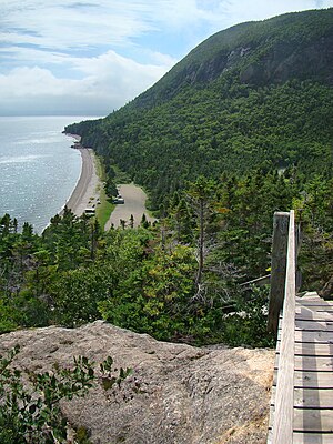
The Bay of Islands ( English for "Bay of Islands") is located on the west coast of the island of Newfoundland on the Gulf of St. Lawrence .
At the approximately 15 km wide entrance to the Bay of Islands are several islands, the largest of which are Guernsey Island , Tweed Island and The Pillars . In the center of the bay there is an open water area. To the east, three fjords cut into the Long Range Mountains - North Arm , Middle Arm and, to the south, the Humber Arm . The Middle Arm splits again into the Northern Penguin Arm and the Southern Goose Arm . At the entrance to the Humber Arm is the larger Woods Island . At the end of the Humber Arm is the town of Corner Brook . There the Humber River flows into the bay. On the southwest coast of the Bay of Islands lies the Blow Me Down Provincial Park on a smaller peninsula that protrudes into the bay . The bay is about 25 km wide. The depth of the bay to the end of the Humber Arm is 45 km.


