Beatweiher
| Beatweiher | ||
|---|---|---|

|
||
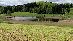
| Beatweiher from its east side. | ||
| Geographical location | Seeshaupt municipality , Weilheim-Schongau district , Upper Bavaria , Germany | |
| Location close to the shore | Magnetsried | |
| Data | ||
| Coordinates | 47 ° 49 '32 " N , 11 ° 13' 37.2" E | |
|
|
||
| Altitude above sea level | 642 m | |
| length | 160 m | |
| width | 75 m | |
The Beatweiher is a natural body of water in the municipality of Seeshaupt , district Magnetsried . The origin of the name could be traced back to the Bethen .
It has an inlet via a small, nameless pond to the south, but no overground outlet.
