Beaumont Ø
| Beaumont Ø | ||
|---|---|---|
| MODIS satellite image of North Greenland with Beaumont Ø in the northwest | ||
| Waters | Lincoln lake | |
| Geographical location | 82 ° 44 '5 " N , 50 ° 44' 4" W | |
|
|
||
| length | 4.3 km | |
| width | 3.5 km | |
| surface | 10.5 km² | |
| Highest elevation | Albert Bjerg 460 m |
|
| Residents | uninhabited | |
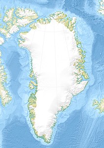
| Map of North Greenland with Beaumont Ø in the northwest | ||
Beaumont Ø is an island belonging to Greenland in the Lincoln Sea . The island is located 26 kilometers north of the Wulff Land peninsula , and 19 kilometers west of the much larger island of John Murray Ø , the closest land mass. The island has a length of 4.3 km and a maximum width of 3.5 km. The surface area is 10.5 km². The island reaches a height of 460 meters in Albert Bjerg.
Beaumont Ø was discovered by Lewis Beaumont (1847-1922), an officer of the British Arctic expedition led by George Nares from 1875/76, who saw her at the end of a sled excursion along the north-west coast of Greenland when he climbed the Wyatt Bjerg and the Windham Hornby Bjerg . The next to see the island was James Lockwood (1852-1884), a participant in the tragic US expedition of Adolphus Greely in the First International Polar Year 1882/83. The island was first set foot on in 1917 by the participants of the Second Thule Expedition , led by Knud Rasmussen , and mapped by Lauge Koch .
Individual evidence
- ^ Greenland Pilot. Sailing Directions for West Greenland (PDF; 33.45 MB). Danish Geodata Agency, 1st edition 2018, p. 216. ISBN 978-87-92107-92-3
- ^ AW Greely: Arctic Meeting at Chickering Hall, November 21st, 1884. Reception of Lieut. AW Greely, US Army, and His Surviving Companions in the Exploration of the Arctic . In: Journal of the American Geographical Society of New York . Volume 16, 1884, pp. 311–344, here p. 315 (English)
- ^ AW Greely: Arctic Meeting at Chickering Hall, November 21st, 1884. Reception of Lieut. AW Greely, US Army, and His Surviving Companions in the Exploration of the Arctic . In: Journal of the American Geographical Society of New York . Volume 16, 1884, pp. 311–344, here p. 321 (English)
- ↑ Beaumont Ø . Map of the Danish Geodetic Institute (1932) based on Lauge Koch's land survey from 1917.


