Berliner Platz (Lübeck)
The Berliner Platz is a place in Lübeck .
location
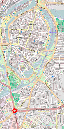
Berliner Platz is located south of the old town in the St. Jürgen district , where Possehlstraße , St.-Jürgen-Ring , Geniner Straße and Berliner Straße meet. It represents the southern end of Possehlstrasse.
history

Berliner Platz emerged from a street junction that has been growing in stages at this point since the end of the 19th century. Initially, only the tracks of the southward Lübeck-Büchener railway crossed Geniner Strasse there. In 1898 the newly laid out St.-Jürgen-Ring was added to the east.
In 1908 the railway got a new route; the tracks were dismantled and the embankment lay fallow for over a decade before Possehlstraße was built in 1920, which led from Geniner Straße to Holstentor .
In 1956, Possehlstrasse was expanded into an important inner-city connecting road. Its direct southern extension to Kronsford Allee on the old embankment was planned (and was implemented in 1960). The resulting large intersection was designed in the same train as a roundabout according to the ideas of the time about optimized traffic flow control .
The square created by the construction of the roundabout was initially nameless. In 1959 he was awarded the occasion of the establishment of a Berlin milestone (a memorial stone with the Berlin coat of arms bears and the indication of the distance to Berlin; such federally funded stones were erected as a memorial to German unity in numerous German cities since 1954) on the day of the home 's name Berliner Platz . Accordingly, the extension of Possehlstrasse on the south side of Berliner Platz that was laid out in the following year became known as Berliner Strasse . The milestone is since May 2015 under monument protection .
Today the federal highway 75 and the federal highway 207 intersect here .
literature
- Roswitha Ahrens / Karl-Ernst Sinner: Why the Kohlmarkt is called "Kohlmarkt" . Archive of the Hanseatic City of Lübeck 2011, ISBN 978-3-7950-5204-1 .
- Statistical Office of the Hanseatic City of Lübeck: Lübeck in Figures , 1956.
Coordinates: 53 ° 51 ′ 4.5 " N , 10 ° 40 ′ 56.8" E

