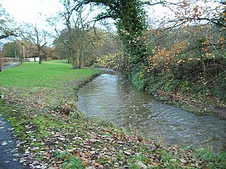
Bezza Brook
|
Bezza Brook Wilcock Brook in the upper reaches |
||
|
The Bezza Brook after rains |
||
| Data | ||
| location | Lancashire | |
| River system | River Ribble | |
| Drain over | River Ribble → Irish Sea | |
| River basin district | North West | |
| source | eastern edge of Balderstone 53 ° 47'5 " N , 2 ° 33'7" W. |
|
| muzzle | in the River Ribble coordinates: 53 ° 46 ′ 30 " N , 2 ° 37 ′ 22" W 53 ° 46 ′ 30 " N , 2 ° 37 ′ 22" W
|
|
The Bezza Brook is a watercourse in Lancashire , England . It arises on the eastern edge of Balderstone and flows initially under the name Wilcock Brook in a westerly direction. It flows north of Samlesbury from the right into the River Ribble .
