Biritinga
| Biritinga | ||
|---|---|---|
|
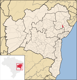
Coordinates: 11 ° 37 ′ S , 38 ° 48 ′ W Biritinga on the map of Bahia
|
||
| Basic data | ||
| Country |
|
|
| State |
|
|
| Residents | 14,836 (2010) | |
| Detailed data | ||
| surface | 553,762 | |
| height | 249 m | |
| prefix | +55 75 | |
| City Presidency | Antonio Celso Avelino de Queiroz | |
Biritinga , officially Município de Biritinga , is a small town in the interior of the state of Bahia in Brazil . The population was estimated on July 1, 2019 at 15,979 inhabitants with a land area of around 554 square kilometers.
Location and infrastructure
Biritinga is about 20 kilometers from Serrinha and about 80 kilometers from Feira de Santana . The nearest international airport is in Salvador da Bahia .
The place was formerly known as Manga and belonged to the municipality of Serrinha.
The city is located on one of the most important north-south routes for Brazilian freight traffic.
economy
Almost the entire land area of Biritinga is used for agriculture. The majority of the population is therefore also active in this sector. The main products of local agriculture are: beef , beans , corn , cashew nuts and cassava .
Sons and daughters
- Manoel Delson Pedreira da Cruz OFMCap (* 1954), Roman Catholic religious, Archbishop of Paraíba
Web links
- Instituto Brasileiro de Geografia e Estatística (IBGE): Bahia: Biritinga. Retrieved January 21, 2018 (Portuguese).
- Atlas do Desenvolvimento Humano do Brasil: Biritinga. Retrieved January 20, 2018 (Portuguese).
Individual evidence
- ↑ IBGE to Biritinga. Retrieved August 28, 2019 .
- ↑ Bahia | Biritinga | Histórico. In: gov.br. cidades.ibge.gov.br, accessed January 21, 2018 (Portuguese).

