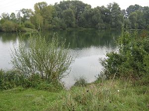
Birkensee (Dingolfing)
| Birch Lake | ||
|---|---|---|

|
||
| The Birkensee on September 18, 2009 | ||
| Geographical location | Bavaria | |
| Places on the shore | Yards | |
| Data | ||
| Coordinates | 48 ° 38 '6 " N , 12 ° 27' 26" E | |
|
|
||
| Altitude above sea level | 355 m | |
| surface | 2.4 ha | |
| length | 240 m | |
| width | 215 m | |
| scope | 865 m | |
The Birkensee is a quarry pond in the urban area of Dingolfing , district of Höfen , which used to be used for gravel extraction and has been used as a leased club water for sport fishing since around 1980 . It is around 240 m long and has an area of 2.4 ha .
An approx. 100 m long peninsula extends into the water from the north to the southeast . The lake is only about 10 m away from the Längenmühlbach , which flows past in the south and which was artificially created around 1860. Just a few meters further east is another quarry pond with a size of around 0.3 hectares.
