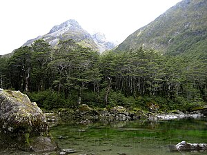
Blue Lake (Tasman)
|
Blue Lake Rotomairewhenua |
||
|---|---|---|

|
||
| Aerial view from Blue Lake | ||
| Geographical location | Nelson Lakes National Park , Tasman South Island , New Zealand | |
| Tributaries | three streams (brooks) | |
| Drain | West Branch of the Sabine River | |
| Data | ||
| Coordinates | 42 ° 3 '31 " S , 172 ° 39' 26" E | |
|
|
||
| Altitude above sea level | 1185 m | |
| length | 385 m | |
| width | 97 m | |
| scope | 915 m | |
| Maximum depth | 7 m | |
|
particularities |
Clearest lake in the world |
|
The Blue Lake ( Māori Rotomairewhenua ) is a small, extremely clear lake in the Nelson Lakes National Park of the Tasman District on the South Island of New Zealand .
geography
The seven meter deep Blue Lake is located about 32 km south-southwest of Saint Arnaud and about 39 km southeast of Murchison on the western flank of the 2340 m high Mount Franklin , which is part of the Franklin Ridge . To the west of the small lake, which is 385 m long, 97 m at its widest point and has a shore length of around 915 m, lie the southern foothills of the Mahanga Range , from which the lake primarily feeds. About 745 m south-southeast is Lake Constance , which drains to the south , separated only by a 1400 m high ridge from Blue Lake , whose outflow is the West Branch of the Sabine River .
The sea
The specialty of the Blue Lake is that it has the clearest water that has ever been documented for a lake. The horizontal visibility in the lake is between 70 and 80 meters, as a study in 2011 showed. In comparison, according to a statement by scientist Rob Davies-Colley from the NIWA Institute , distilled water has a visibility of around 80 meters. The blue-violet color of the lake is due to the clarity of the water.
The scientists from the NIWA Institute assume that the Blue Lake , which has a water temperature between 5 ° C and 8 ° C, is likely to be fed underground by seepage through Lake Constance at a higher level . It is believed that the debris from a landslide, which lies between the two lakes and has formed a dam, filters the water in a special way.
tourism
West of the end of the lake, which is at an altitude of 1185 m , is the Blue Lake Hut at 1190 m , a refuge for hikers who hike the Blue Lake Track , the Moss Pass Route or the Wairau Pass Route . The hut has 16 beds. The hut accommodates around 700 hikers annually.
The lake is on the north lying West Sabine Hut to reach over 3.5 hours walking time and they exit at Lake Rotoroa located Sabine Hut within 5 hours.
Meaning for the Māori
The Blue Lake is located in the Rohe (tribal area) of the Iwi Ngāti Apa ki te Rā Tō . As part of the 2010 Treaty of Waitangi agreements, it was returned to the property of the tribe, who then returned it to the Crown. The lake was traditionally used in ceremonies in which the bones of dead men were cleansed and the soul of the deceased was released on his journey to mythical Hawaiki . For the Iwi, the water of the lake is therefore untouchable or holy ( “ tapu ” ). The Lake Constance have been used for the same purpose in female deceased. The name of the lake in the Māori language , Rotomairewhenua , means "land of peaceful waters" .
Web links
- Nelson's Blue Lake - The clearest freshwater ever reported . NIWA, December 19, 2011,accessed April 2, 2018.
- Nelson's Blue Lake clearest . In: New Zealand Herald . NZME. Publishing, December 20, 2011,accessed April 2, 2018.
- Jonathan Carson : Blue Lake a New Zealand treasure . In: Nelson Mail . Faifax Media , February 28, 2015, accessed April 2, 2018 .
Individual evidence
- ↑ a b c d Coordinates and length determinations were partly made via Google Earth version 7.1.8.3036 on April 2nd, 2018.
- ↑ a b c d Nelson’s Blue Lake - The clearest freshwater ever reported . NIWA , December 19, 2011, accessed April 2, 2018 .
- ↑ a b Topo250 maps . Land Information New Zealand , accessed April 2, 2018 .
- ↑ a b c Blue Lake Hut . Department of Conservation , accessed April 2, 2018 .
- ↑ West Sabine Hut . Department of Conservation , accessed April 2, 2018 .
- ^ Ngāti Apa ( North Iceland ). New Zealand Government , January 6, 2017, accessed April 2, 2018 .

