Boa Esperança Reservoir
| Boa Esperança Reservoir | |||||||
|---|---|---|---|---|---|---|---|
|
|||||||
|
|
|||||||
| Coordinates | 6 ° 42 ′ 21 ″ S , 43 ° 44 ′ 11 ″ W | ||||||
| Data on the structure | |||||||
| Construction time: | 1970 | ||||||
| Height of the barrier structure : | 53 m | ||||||
| Crown length: | 5 212 m | ||||||
| Power plant output: | 237.3 MW | ||||||
| Data on the reservoir | |||||||
| Altitude (at congestion destination ) | 304 m. ü. NN | ||||||
| Water surface | 352.2, 384 (or 1800?) Km² | ||||||
| Reservoir length | 150 km | ||||||
| Storage space | 5100 million m³ | ||||||
| Catchment area | 85,000 (or 87,500) km² | ||||||
| Design flood : | 12 000 m³ / s | ||||||
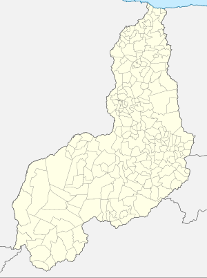
The Boa Esperança Reservoir (Portuguese Barragem de Boa Esperança ; German “Good Hope”) is a reservoir on the Rio Parnaíba with a hydroelectric power station . The power plant, the Usina Hidrelétrica de Boa Esperança , uses four Francis turbines to generate electricity for the Brazilian state of Piauí . The hydroelectric power station used to be called Usina Hidrelétrica Marechal Castelo Branco . The operator of the hydropower plant is the company CHESF , Companhia Hidrelétrica do São Francisco, also known as Eletrobras Chesf.
The barrier structure, a heaped up dam , is located in the municipality of the municipality of Guadalupe . Construction began in 1964 and it took six years to complete.
The Parnaíba forms the border between the states of Piauí and Maranhão throughout the reservoir and beyond . The storage volume of the reservoir is 5100 million m³. The size specifications for the area are contradictory: the lake area should be 352.2, 384 or even 1800 km².
See also
- List of the largest dams on earth
- List of the largest reservoirs on earth
- List of the largest hydroelectric plants in the world
- List of dams in the world
