
Boehn barracks
|
|
|||
|---|---|---|---|

Former staff building after the conversion |
|||
| country | Germany | ||
| today | residential area | ||
| local community | Hamburg | ||
| Coordinates : | 53 ° 36 ' N , 10 ° 8' E | ||
| Opened | 1936-1938 | ||
| Formerly stationed units | |||
| before 1993: parts of the 6th Panzer Grenadier Division before 1956: parts of the British Rhine Army before 1945: 76th Infantry Regiment |
|
||
Location of the Boehn barracks in Hamburg |
|||

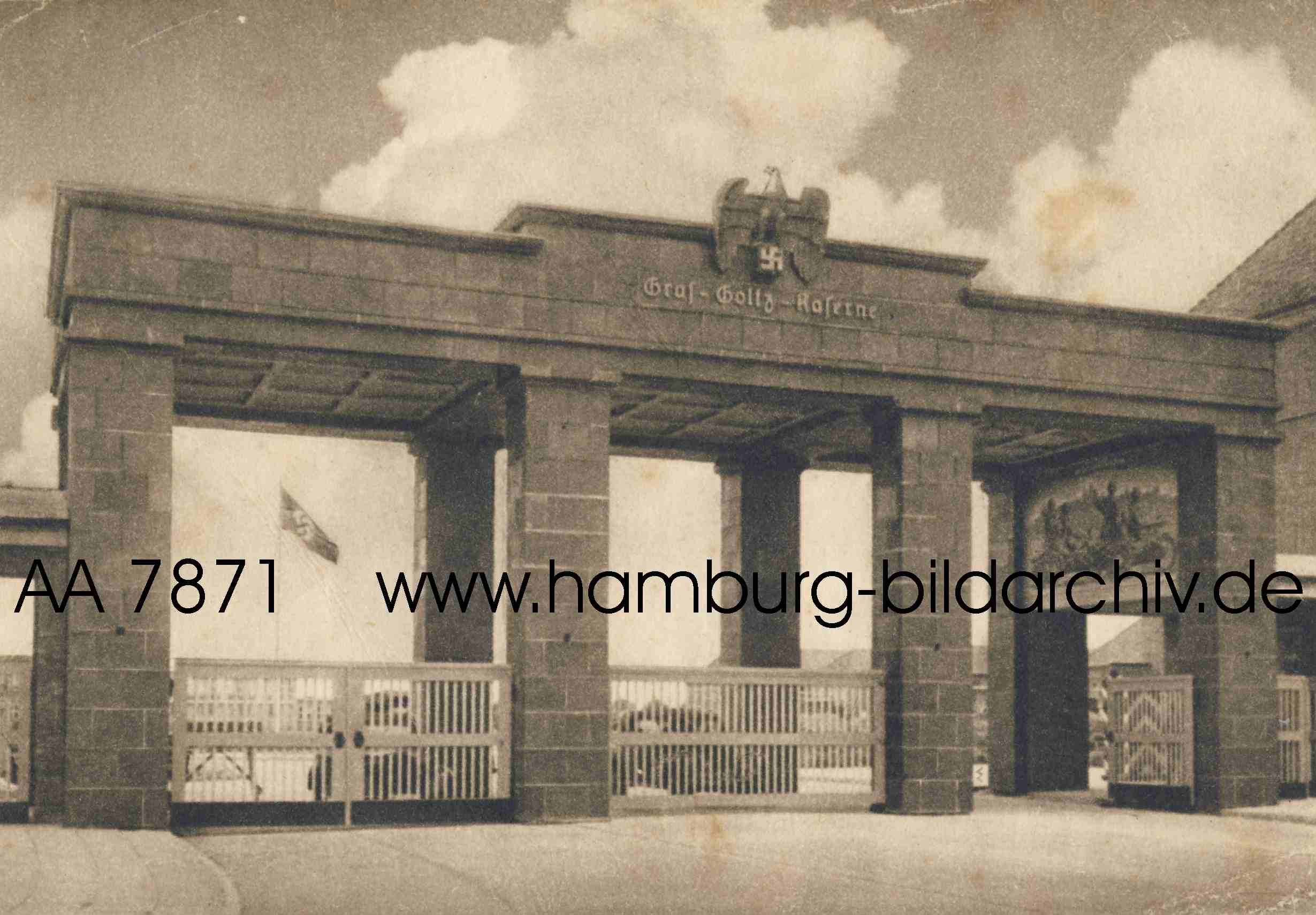
The Boehn barracks was a barracks complex in Hamburg-Rahlstedt that was used by the military from 1938 to 1993. Residential houses were built on the site after 1993.
history
The barracks were built from 1936 to 1938 and named after General Max von Boehn . Initially units of the 76th Infantry Regiment were stationed here, after the outbreak of World War II the associated Grenadier Replacement and Training Battalion (mot) 76. In the further course of the war, parts of the area were also used as a hospital for the Hamburg civilian population. During the war there was only one bomb hit on an accommodation building.
After 1945 the British Army used the site. After the rearmament , the barracks were handed over to the newly founded Bundeswehr on August 9, 1956 . The accommodations were in the northern part of the site on Timmendorfer Strasse , there were two gates, and the main station was on the western side. The vehicle hangar and technical area were located in the southern part on Scharbeutzer Straße , there was also a gate. In the eastern part, a sanitary area, an underground bunker system and sports and exercise facilities were built later. In the center of the complex was a place mainly used for roll calls and formal service .
After the last Bundeswehr units had left the barracks, various ideas for subsequent use were discussed, including by the Hamburg police. The barracks have been closed since September 30, 1993.
| Formerly stationed units of the Bundeswehr: |
|---|
|
Reuse
The opportunity arose for the site to build a new residential area in an area with good infrastructure. The city of Hamburg agreed with the development company founded by credit institutions and building cooperatives that at least 80% of the housing construction should be earmarked for publicly subsidized housing . Construction began in 1996 and was largely completed by 2000, with 1727 apartments and 160 terraced houses being built . Most of the old barracks buildings were demolished, only in the western area were 3 blocks converted into apartments. The arcade arches in the area of the old main entrance were still preserved. One of the blocks still shows the typical appearance of barracks accommodation. The location of the former barracks can be recognized today mainly by the course of the streets and the arrangement of the houses. The central square with its trees is integrated as an open space, and a row of shops was created on Scharbeutzer Straße .
photos

Arcade arches at the former main entrance

Lindenallee on the former central square

Entrance of the former staff building

Today's Ahrenshooper Straße , formerly the western main street


Individual evidence
- ^ A b Dirk Schubert: Hamburg residential quarters . Dietrich Reimer Verlag, Berlin 2005, ISBN 3-496-01317-6 , p. 308 .
- ↑ See also the map on panzergrenadierbrigade17.de . Retrieved December 30, 2014.
literature
- Dirk Schubert: Hamburg's residential areas . Dietrich Reimer Verlag, Berlin 2005, ISBN 3-496-01317-6 , p. 308-311 .
- State Office for Geoinformation and Surveying (Ed.): Hamburg in aerial photographs and pictures, 1933 to 1963 . Sutton Verlag, Erfurt 2011, ISBN 978-3-86680-824-9 , p. 105 .
Web links
- MGFA.de - location database of the Military History Research Office Potsdam (units stationed in the Boehn barracks can be reached by searching for postcode 22147)
- Relkte.com: Structure of the SCHLESWIG-HOLSTEIN Territorial Command. (PDF; 992 kB) Accessed March 27, 2013 .
- Panzergrenadierbrigade17.de presents the Boehn barracks. Retrieved December 22, 2014 .
- Photo of the accommodation blocks from 1935 on hamburg-bildarchiv.de .