Ponds
| Ponds | ||
|---|---|---|

|
||
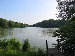
| Brückweiher, 2012 | ||
| Geographical location | Jägersburg , Saarland , Germany | |
| Tributaries | Erbach , Felsbach | |
| Drain | Erbach | |
| Data | ||
| Coordinates | 49 ° 21 '53 " N , 7 ° 18' 48" E | |
|
|
||
| surface | 7.1 ha | |
The Brückweiher is an artificially created pond (actually a reservoir ) near Jägersburg , city of Homburg in Saarland .
location
The bridge pond has a size of about 7.1 hectares and is located in the local recreation area Jägersburg. Here flows through Lauterbach initially the castle pond and two smaller ponds, then the bridge pond and finally on the other side of the Kleinottweiler road ( B 423 ) to Möhlwoog . The pond was built around 1959 by American soldiers who were stationed in Zweibrücken and wanted a body of water for trout fishing.
Tourist development
There are several leisure facilities around the Brückweiher, including barbecue areas, sunbathing areas, the climbing park Adventure Park Homburg , the arboretum , in which rare woods grow, as well as a boat rental . The lake can be ridden with rowing boats and pedal boats. The Walter Boßlet hiking trail leads around the lake .
The pond is used as a fishing pond. The following fish species live in the water: eel, perch, bream, pike, carp, grass carp, silver carp, roach, rudd, crucian carp, tench, catfish and pikeperch. The bridge pond may only be fished by members of the Jägersburg fishing club.
Web links
Individual evidence
- ↑ Local recreation area Jägersburg , on the Saarpfalz Touristik website
- ^ Chronicle of the fishing club , Angelsportverein Jägersburg eV
- ↑ Jägersburg fishing club
