Jägersburg
|
Jägersburg
City of Homburg
|
||
|---|---|---|
| Coordinates: 49 ° 22 ′ 17 ″ N , 7 ° 19 ′ 18 ″ E | ||
| Height : | 270 m above sea level NHN | |
| Residents : | 3082 (Jun. 1, 2020) | |
| Incorporation : | 1st January 1974 | |
| Postal code : | 66424 | |
| Area code : | 06841 | |
|
Location of Jägersburg in Saarland |
||


Jägersburg (in the local dialect Järschborch or Jächersburch ) is a district of the Saarland district town Homburg in the Saarpfalz district . The municipality, which was independent in the district of Homburg until the end of 1973 , now has the status of a municipal district with its own mayor and local council, who advises the city council.
geography
location
Jägersburg is approx. 5 km northwest of Homburg at an altitude of 270 m above sea level. NHN .
Local division
In addition to the main town Jägersburg with 2,685 inhabitants, Altbreitenfelderhof with 124 inhabitants and Websweiler with 273 inhabitants belong to the district Jägersburg with a total of 3,082 inhabitants (as of June 1, 2020).
Watershed
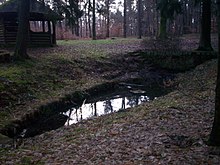
The watershed between Erbach / Blies and Glan / Nahe runs through the local area .
history
The place Jägersburg emerged during the second Franconian settlement around 750 on the remains of a Gallo-Roman settlement as Hattweiler near the present-day town of Homburg (Jägersburg was only given its current name in 1749). Numerous barrows in the woods around the place testify to prehistoric settlement sites.
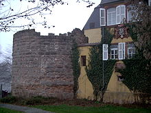
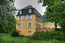
Today's Jägersburg Castle and Palace Museum is located in the remains of the Hattweiler moated castle , which Duke Gustav Samuel Leopold had the Swedish architect Jonas Erikson Sundahl rebuilt into the Gustavsburg hunting lodge . The castle was first mentioned in 1272 with the lords of the castle Berthelo (Bartholomaeus) de Hetwilre and his wife (uxor) Salmine, daughter of Conrad called Colbe de Butreville. In the following years the castle changed hands frequently and other illustrious names appear in the annals.
The Wittelsbach Duke Christian IV of Pfalz-Zweibrücken built the hunting lodge Schloss Jägersburg not far from the old castle from 1752 to 1756 . This early Classicist castle with its extensive park served the Duke's passion for hunting until Charles II August moved his court to the Karlsberg in 1778 . It was completely destroyed by the French and farmers in 1793 .
The famous Royal Deux-Ponts regiment , established by Duke Christian IV on behalf of the King of France, began its recruitment in the hunting barracks of the hunting lodge. The regiment distinguished itself in the Battle of Yorktown ( USA ), passed into French possession during the French Revolution and was disbanded after several renaming in 2000.
As part of the regional and administrative reform in Saarland , the previously independent municipality Jägersburg was assigned to the city of Homburg on January 1, 1974 and has been a district and a municipality since then.
Attractions
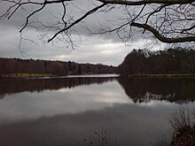
The place is located in the middle of extensive forests, which still belong to the foothills of the Palatinate Forest , and is known for its many ponds which together cover a water surface of approx. 25 hectares . The largest being the Möhlwoog (7.4 hectares), the bridge Weiher (7.09 hectares), Schlossweiher (1.71 hectares) and in Jägersburger reserve Forest / Königsbruch preferred Spickelweiher (3 hectare). The entire area around the village serves as a local recreation area that is visited by many visitors from Saarland and the neighboring western Palatinate . In addition to the ponds, there are other attractions above all at the Brückweiher, including: The Homburg Adventure Park - a climbing park with different levels of difficulty (transarbore pond crossing on steel cable and back again), the arboretum , in which rare woods grow, as well as a boat rental and a log cabin .
The Jägersburger Strandfest takes place every year around the first weekend in July. It gives the castle pond a romantic atmosphere, especially at night. At the end there is a big firework display over the pond.
Herrgottshübel youth campground
The Herrgottshübel youth tent, founded in 1969, is located on the north-western outskirts of the village towards Altbreitenfelderhof . This is from the Jägersburger pathfinder e. V. (run by the German Scout Association St. Georg ). Many youth groups from home and abroad meet here every year for traditional tent camps. The locals also affectionately call the Herrgottshübel “Ichelsburch” (Igelsburg).
traffic
Jägersburg is crossed by the federal highway 423 .
On the abandoned route of the Glantalbahn there is the old station , which was abandoned as a passenger station in the mid-1950s.
literature
- Rudolf Drumm: The village of Jägersburg and its hunting castles. Publishing house of the Jägersburg community, Jägersburg 1954.
- Joachim Conrad, Stefan Flesch (ed.): Castles and palaces on the Saar . Minerva-Verlag Thinnes & Nolte, Saarbrücken 1988, ISBN 3-477-00078-1 .
- Ulrich Vicari: From Hattwilre to Jägersburg. The history of a village in the Saar-Palatinate until 1800. With collection of documents until 1599. Self-published, Jägersburg 1989.
- Ralf Schneider: Palaces and country houses of the dukes of Pfalz-Zweibrücken in the upper offices of Zweibrücken and Homburg in the 18th century. Architecture, interior, garden art. Self-published, Rottenburg 2003.
- Helmut Steitz: 100 years of Websweiler. Self-published, Homburg 1995.
- Philippe Cachau : Le château de Christian IV, duc des Deux-Ponts, à Jägersburg. Un château français en Allemagne (1752-1756). , In: Francia , No. 39, Institut Historique Allemand, Paris, 2012, pp. 135-165.
Web links
- Private website on Jägersburg (Memento from November 30, 2016 in the Internet Archive)
- Literature about Jägersburg in the Saarland Bibliography
Individual evidence
- ↑ a b Homburg: Data and facts, residents by district , accessed on July 6, 2020
- ^ Federal Statistical Office (ed.): Historical municipality directory for the Federal Republic of Germany. Name, border and key number changes in municipalities, counties and administrative districts from May 27, 1970 to December 31, 1982 . W. Kohlhammer, Stuttgart / Mainz 1983, ISBN 3-17-003263-1 , p. 803 .
- ↑ Homepage of the youth tent site Herrgottshübel


