Brandshofer lock
| Brandshofer lock | ||
|---|---|---|
|
Brandshofer lock |
||
| location | ||
|
|
||
| Coordinates | 53 ° 32 '25 " N , 10 ° 1' 30" E | |
| Country: | Germany | |
| Place: | Hamburg | |
| Waters: | Elbe , Bille | |
| Data | ||
| Owner: | FHH | |
| Operator: | State Office for Roads, Bridges and Waters (LSBG) | |
| lock | ||
| Usable length: | 69.50 m | |
| Usable width: | 11.50 m | |
| Others | ||
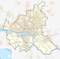
The Brandshof lock between Hamburg-Rothenburgsort and Hamburg-Hammerbrook connects the Bille with the Oberhafenkanal and thus with the Elbe . The first lock structure at this point was built in 1625–1626 and named after the court of Hamburg's mayor Johann Brand (1585–1652), which was located here at the time . The Brandshofer lock replaced the Bullenhuser locks located further up the bill (e.g. at today's Green Bridge), which were built around 1485 and destroyed during the carnival flood in 1625 .
Individual evidence
- ↑ Geoportal Hamburg , accessed on May 9, 2019
- ^ The development of the Hammerbrook district up to 1900
- ^ Heinz Aschenberg, Gerhard Kroker: Storm surges and flood protection in Hamburg. An outline of the history of dike construction and internal drainage in the Elbe river splitting area , ed. by the building authority of the Free and Hanseatic City of Hamburg, Hamburg 1992, p. 24.
literature
- Usage regulations for the water locks of the authority for the environment and energy from March 22, 2010 in the version of the 1st amendment of October 12, 2015, Official Gazette - Part II of the Hamburg Law and Ordinance Gazette, No. 86, November 3, 2015, P. 1869
Web links
Commons : Brandshofer Schleuse - Collection of images, videos and audio files

