Bratina Island
| Bratina Island | ||
|---|---|---|
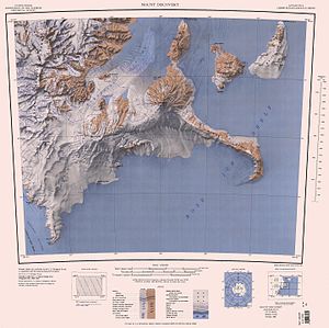
| Topographic map (1: 250,000) with Bertina Island (top center) | ||
| Waters | Ross Ice Shelf , Ross Sea | |
| Archipelago | Ross Archipelago | |
| Geographical location | 78 ° 1 ′ S , 165 ° 32 ′ E | |
|
|
||
| Highest elevation | 160 m | |
| Residents | uninhabited | |
Bratina Island is a small island in the Ross Archipelago . It is enclosed by the Ross Ice Shelf on the northern tip of the Brown Peninsula off the Scott coast of the East Antarctic Victoria Land .
The Advisory Committee on Antarctic Names named them in 1963 after Joseph H. Bratina (1914-2006), chief aircraft machinist of the VX-6 flight squadron at McMurdo Station from 1958 to 1959, from 1960 to 1961 and from 1961 to 1962.
Web links
- Bratina Island in the Geographic Names Information System of the United States Geological Survey (English)
- Bratina Island on geographic.org (English)

