Küçükçekmece Gölü
| Küçükçekmece Gölü | ||
|---|---|---|

|
||
| Geographical location | Istanbul ( Turkey ) | |
| Tributaries | Nakkas, Sazlidere, Eksinoz | |
| Drain | to the Sea of Marmara | |
| Data | ||
| Coordinates | 41 ° 0 ′ 23 " N , 28 ° 44 ′ 42" E | |
|
|
||
| Altitude above sea level | 0 m | |
| surface | 16 km² | |
| length | 10 km | |
| width | 6 km | |
| Maximum depth | 20 m | |
The Küçükçekmece Gölü (Küçükçekmece Lake) is located in the Marmara region , between the Istanbul districts Küçükçekmece and Avcılar .
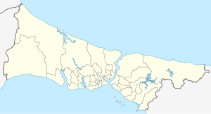
It is located around 23 km west of central Istanbul at sea level. The tides displaced sand and rocks in such a way that a narrow lake was formed and separated the lake from the Sea of Marmara . The narrowness is interrupted on the south side. This gap directs the excess water into the Sea of Marmara. When the sea is choppy, sea water enters the lake, which makes the sea water a little salty. The lake is fed by the tributaries Nakkas, Sazlıdere and Eksinoz flowing in from the north.
Küçükçekmece Lake is 10 km long and 6 km wide. Its area is 16 km² and its maximum depth is 20 m. Küçükçekmece and Avcılar are located on the lake.
Remarks
- ↑ Hale Mamunlu: Urban redevelopment projects as an instrument of open space planning in the metropolitan region of Istanbul , in: Uwe Altrock (Ed.): Megacities and Urban Renewal , Technical University Berlin, 2009, pp. 71–82, here: p. 78.
