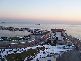
Avcılar
| Avcılar | |||
|
|||
 Coastal zone |
|||
| Basic data | |||
|---|---|---|---|
| Province (il) : | Istanbul | ||
| Coordinates : | 40 ° 58 ' N , 28 ° 43' E | ||
| Surface: | 41.92 km² | ||
| Residents : | 417,852 (2014) | ||
| Population density : | 9,968 inhabitants per km² | ||
| Telephone code : |
(+90) 212 (European part) (+90) 216 (Asian part) |
||
| Postal code : | 34 xxx | ||
| License plate : | 34 | ||
| Structure and administration (as of 2019) | |||
| Mayor : | Turan Hançerli ( CHP ) | ||
| Website: | |||
| Avcılar County | |||
| Kaymakam : | Hulusi Dogan | ||
| Website (Kaymakam): | |||
Avcılar is the capital of the district of the same name in the Turkish province of İstanbul and a district on the European side of İstanbul . Avcılar has 417,852 inhabitants (as of 2014).
City structure
The district of Avcılar was separated from the Küçükçekmece district on May 27, 1992 (resolution 3806 of the Council of Ministers) and thus became a separate district. The foundation was made by merging the following Mahalles :
- Merkez
- Denizköşkler
- Ambarlı
- Cihangir
- Mustafa Kemal Paşa
- Firuzkoy
- University
- Gümüşpala
- Yeşilkent
- Tahtakale
The district opened on October 12, 1992.
Economy and Infrastructure
The headquarters of the third largest industrial and financial group in Turkey, Zorlu Holding , is located in Avcılar. The company's head office was moved from Denizli to Avcılar in 1970 and is located in a skyscraper. Zorlu Holding controls 50 companies, many of which are national market leaders in their respective fields. The group has 30,000 employees and operates in 110 countries.
The Ambarlı Limanı is the most important and largest seaport in Turkey and is located in Avcılar. Around 38 percent of Turkish imports and exports and 63 percent of the Marmara region are handled in the port . The port employs around 9,300 people in 7 terminals and had an export volume of 24 billion US dollars in 2007 . The Ambarlı Limanı exports important products that were produced in Turkey, e.g. B. Raw materials such as vegetables, fruit or tobacco. Furthermore, the port is a central point of contact for the supply of Istanbul and the Marmara region with crude oil.
Population development
After the Balkan War of 1912, the product marketed by the Balkan Muslim and Turkish population, were the so-called Balkan Turks , from the Bulgarian places Razgrad , vetovo and Pazardzhik located in Avcılar. In the 1960s, many people from Thrace and Anatolia came to Avcılar. Until the second half of the 20th century , Avcılar was still a small agricultural village on the coast of the Marmara Sea . The district has grown enormously since the 1980s. The migration came from all parts of Turkey, over half of them from the provinces of Sivas , Tokat and Kars .
| Population development Avcılar | ||||||||||||
|---|---|---|---|---|---|---|---|---|---|---|---|---|
| year | 1990 | 1997 | 2000 | 2008 | 2014 | |||||||
| Residents | 126,282 | 214.383 | 235.113 | 333,944 | 417.852 | |||||||
Web links
Individual evidence
- ^ Turkish Institute for Statistics, 2014 ( Memento from February 10, 2015 on WebCite ), accessed April 25, 2015


