
Kars (province)
| Kars | |
|---|---|
| Province number: | 36 |
  |
|
| Counties | |
 |
|
| Basic data | |
| Coordinates: | 40 ° 27 ' N , 43 ° 4' E |
| Provincial capital: | Kars |
| Region: | Eastern Anatolia |
| Surface: | 10,193 km² |
| Population: | 288,878 (2018) |
| Population density: | 28 inhabitants / km² |
| Political | |
| Governor: | Turk Öksüz |
| Seats in Parliament: | 3 |
| Structural | |
| Telephone code: | 0424 |
| Features : | 36 |
| Website | |
| www.kars.gov.tr (Turkish) | |
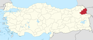
Kars ( Kurdish Qers ) is a Turkish province in the northeast of the country on the border with Armenia and thus a border region between Eastern Anatolia and Transcaucasia . Their capital is the Kars of the same name . The neighboring provinces are Ardahan in the north, Erzurum in the west, Ağrı and Iğdır in the south. In the east, the district borders on Armenia.
geography
The province has several mountains over 3000 m high. Extensive plateaus (51%) and mountains (38%) take up most of the area. Only 11% are flat. The most important rivers are Aras , Kars Çayı and the border river Achurjan . Important lakes are Çıldır Gölü and Aygır Gölü . Almost a third of the population lives in the provincial capital, which is also the largest city.
The climate is continental with strong seasonal temperature fluctuations. In winter, -40 ° C and in summer +35 ° C are possible. The annual rainfall is about 500 mm. The natural vegetation in Kars is steppe.
Administrative division
The following eight districts ( İlçe ) belong to the province of Kars :
| district | Area 1 (km²) |
Population (2018) 2 | Number of Units | Density (Ew / km²) |
urban share (in%) |
Sex ratio 3 |
Founding date 4 5 |
|||
|---|---|---|---|---|---|---|---|---|---|---|
| District ( İlçe ) | Administrative headquarters (Merkez) |
Municipalities (Belediye) |
City quarter (Mahalle) |
Villages (Köy) |
||||||
| Akyaka | 417 | 10,985 | 2,026 | 1 | 3 | 27 | 26.3 | 18.44 | 844 | 1987 |
| Arpaçay | 1,165 | 17,373 | 2,858 | 1 | 4th | 48 | 14.9 | 16.45 | 925 | |
| Digor | 1,092 | 22,282 | 2,583 | 2 | 2 | 37 | 20.4 | 27.19 | 914 | 1953 |
| Kağızman | 1,871 | 45,936 | 18,572 | 1 | 9 | 62 | 24.6 | 40.43 | 960 | |
| Merkez | 2,048 | 115.891 | 86,349 | 1 | 23 | 72 | 56.6 | 74.51 | 959 | |
| Sarıkamış | 2,038 | 42,683 | 16.601 | 1 | 9 | 55 | 20.9 | 38.89 | 859 | |
| Selim | 982 | 23,231 | 5,347 | 1 | 3 | 53 | 23.7 | 23.02 | 944 | 1957 |
| Susuz | 578 | 10,497 | 2,393 | 1 | 4th | 27 | 18.2 | 22.80 | 953 | 1959 |
| PROVINCE of Kars | 10.193 | 288,878 | 9 | 57 | 381 | 28.3 | 48.53 | 932 | ||
economy
Most of the population works in agriculture and forestry. The once flourishing trade with the USSR collapsed with the Cold War at the latest .
population
The majority of the population consists of Turks , Azerbaijanis or Karapapaks / Terekeme and Kurds . Kars is a linguistically and ethnically diverse province. Many Armenians and Georgians used to live in Kars . With them all Christian denominations were represented.
Results of the population extrapolation
The following table shows the annual population development at the end of the year after updating by the addressable population register (ADNKS) introduced in 2007. In addition, the population growth rate and the sex ratio (ie number of women per 1000 men) are listed. The 2011 census determined 306,238 inhabitants, which is almost 20,000 more than in the 2000 census.
| year | Population at the end of the year | Population growth rate (in%) |
Gender ratio (women per 1000 men) |
Rank (among 81 provinces) |
||
|---|---|---|---|---|---|---|
| total | male | Female | ||||
| 2018 | 288,878 | 149,510 | 139,368 | 0.43 | 932 | 61 |
| 2017 | 287,654 | 149,481 | 138.173 | −0.74 | 924 | 61 |
| 2016 | 289,786 | 150,515 | 139.271 | −0.98 | 925 | 61 |
| 2015 | 292,660 | 152.040 | 140,620 | −1.28 | 925 | 59 |
| 2014 | 296,466 | 153,676 | 142,790 | −1.47 | 929 | 59 |
| 2013 | 300,874 | 155,625 | 145.249 | −1.29 | 933 | 59 |
| 2012 | 304,821 | 158.403 | 146.418 | −0.31 | 924 | 59 |
| 2011 | 305,755 | 159.179 | 146,576 | 1.32 | 921 | 59 |
| 2010 | 301,766 | 154,817 | 146.949 | −1.56 | 949 | 58 |
| 2009 | 306,536 | 159,411 | 147.125 | −1.79 | 923 | 58 |
| 2008 | 312.128 | 163,678 | 148,450 | −0.02 | 907 | 58 |
| 2007 | 312.205 | 161,787 | 150.418 | - | 930 | 58 |
| 2000 | 325.016 | 169.027 | 155.989 | 923 | 57 | |
Census results
The following tables show the population of the province of Edirne documented in the 14 censuses .
The values in the table on the left are taken from e-books (from the original documents), the values in the table on the right come from the data query of the Turkish statistical institute TÜIK - available on this website:
| year | population | rank | |
|---|---|---|---|
| province | Turkey | ||
| 1927 | 204,846 | 13,648,270 | 28 |
| 1935 | 305,536 | 16.158.018 | 20th |
| 1940 | 356,534 | 17,820,950 | 17th |
| 1945 | 381.176 | 18,790,174 | 18th |
| 1950 | 410.236 | 20,947,188 | 18th |
| 1955 | 487.844 | 24,064,763 | 13 |
| 1960 | 543,600 | 27,754,820 | 13 |
| year | population | rank | |
|---|---|---|---|
| province | Turkey | ||
| 1965 | 606.313 | 31,391,421 | 13 |
| 1970 | 660.018 | 35.605.176 | 13 |
| 1975 | 707.398 | 40,347,719 | 17th |
| 1980 | 700.238 | 44,736,957 | 22nd |
| 1985 | 722.431 | 50,664,458 | 25th |
| 1990 | 662.155 | 56.473.035 | 30th |
| 2000 | 325.016 | 67,803,927 | 57 |
Number of provinces in relation to the census years:
- 1927, 1940 to 1950: 63 provinces
- 1935: 57 provinces
- 1955: 67 provinces
- 1960 to 1985: 73 provinces
- 1990: 73 provinces
- 2000: 81 provinces
history
The province lies at the intersection of Asia Minor and the Caucasus . Therefore, it often changed hands. For several decades, Kars belonged to the Armenian kingdom, which had its capital in Ani . The Byzantine Empire finally lost Kars to the Seljuks in 1064 and with them the Islamization and the Turkization of the inhabitants began.
In 1124 it fell into the hands of the Georgians and in 1239 it was overrun by the Mongols . Between 1534 and 1878 Kars belonged to the Ottoman Empire , after the wars of 1829 and 1856 to the Russian Empire. After the war of 1877–1878, Kars belonged continuously to Russia . Around this time, many ethnic groups from Russia settled in Kars, including Russian Duchoborzen (an orthodox sect, also called Malakan in Turkish ), Volga Germans (Swabians), Baltic peoples ( Estonians and Lithuanians ). In 1919 the proportion of these peoples was 40%.
After the end of the First World War , Russia handed Kars over to Turkey after the peace treaty of Brest-Litovsk with Germany . During the First World War, over 90,000 Turkish soldiers froze to death and starved to death in the mountains in Sarıkamış due to mistakes made by the commanders. Temporarily in Armenian hands, Kars was conquered for Turkey in October / November 1920 by Kâzım Karabekir Paşa. During the Second World War it was an important military base. Until 1992, the now independent provinces of Ardahan and Iğdır belonged to Kars.
politics
When the tsarist troops withdrew into the interior of Russia because of the October Revolution, the Russian district of Kars had declared itself independent, as did the other districts, for example. B. Georgia, Armenia. He called himself the Government of the Republic of Southwest Caucasus (Ottoman: Cenubi Garbi Kafkas Hükûmet-i Cumhuriyesi ). This state included the districts of Batumi , Akhaltsikhe , Akhalkalaki (now Georgia), Gyumri -Sirak (now Armenia), today's Turkish provinces of Artvin, Ardahan, Igdir and last Nakhetschewan (now in Azerbaijan). This state lasted only nine months and was only recognized by the Japanese Empire. In autumn 1919, under pressure from the Armenian Republic, this state was dissolved and the entire cabinet was deported to Malta .
Personalities
- Vladimir Kiriakowitsch Triandafillow (1894–1931), Soviet military theorist
- Mariam Aslamasjan (1907–2006), Armenian-Russian painter and graphic artist
- Qanatê Kurdo (1909–1985), Yezidi author, linguist and academic
- Jeranuhi Aslamasjan (1910–1998), Armenian-Russian painter and graphic artist
- Azer Bülbül (1969–2012), singer
Web links
Individual evidence
- ↑ Türkiye Nüfusu İl ve İlçelere Göre Nüfus Bilgileri , accessed on June 28, 2019.
- ↑ Governor's portrait on the Kars Province website
- ↑ Directorate General of Mapping İl ve İlçe Yüzölçümleri (PDF; 0.25 MB).
- ↑ Türkiye Nüfusu İl İlçe Mahalle Köy Nüfusu , accessed on June 28, 2019.
- ↑ illeridaresi.gov.tr (PDF; 1.4 MB).
- ↑ Genel Nüfus Sayımları (census results 1965 to 2000).
Adana | Adıyaman | Afyonkarahisar | Ağrı | Aksaray | Amasya | Ankara | Antalya | Ardahan | Artvin | Aydın | Balıkesir | Bartın | Batman | Bayburt | Bilecik | Bing oil | Bitlis | Bolu | Burdur | Bursa | Çanakkale | Çankırı | Çorum | Denizli | Diyarbakır | Düzce | Edirne | Elazığ | Erzincan | Erzurum | Eskişehir | Gaziantep | Giresun | Gümüşhane | Hakkâri | Hatay | Iğdır | Isparta | İstanbul | İzmir | Kahramanmaraş | Karabük | Karaman | Kars | Kastamonu | Kayseri | Kırıkkale | Kırklareli | Kırşehir | Kilis | Kocaeli | Konya | Kutahya | Malatya | Manisa | Mardin | Mersin | Muğla | Muş | Nevşehir | Niğde | Ordu | Osmaniye | Rize | Sakarya | Samsun | Siirt | Sinop | Sivas | Şanlıurfa | Şırnak | Tekirdağ | Tokat | Trabzon | Tunceli | Usak | Van | Yalova | Yozgat | Zonguldak