
Amasya (province)
| Amasya | |
|---|---|
| Province number: | 05 |
  |
|
| Counties | |
 |
|
| Basic data | |
| Coordinates: | 40 ° 42 ' N , 35 ° 41' E |
| Provincial capital: | Amasya |
| Region: | Black Sea Region |
| Surface: | 5,628 km² |
| Population: | 337,508 (2018) |
| Population density: | 60 inhabitants / km² |
| Political | |
| Governor: | Dr. Osman Varol |
| Seats in Parliament: | 3 |
| Structural | |
| Telephone code: | 0358 |
| Features : | 05 |
| Website | |
| www.amasya.gov.tr (Turkish) | |
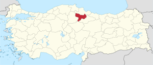
Amasya is a province in the northern Black Sea region of Turkey . The capital is also called Amasya .
The province has a total of 337,508 inhabitants (as of the end of 2018) on an area of 5,628 km². The population density is 60 inhabitants / km². After the population fell until the beginning of the 2010s, the population has been rising steadily since then (→ table).
Amasya borders on the province of Samsun to the north, Çorum to the west , Tokat to the southeast and Yozgat to the south .
population
The following table shows the annual population development at the end of the year after updating by the addressable population register (ADNKS) introduced in 2007. In addition, the population growth rate and are gender relations ( sex ratio h. Number of women per 1,000 men d.) Listed.
The 2011 census determined 323,331 inhabitants, almost 42,000 fewer than in the 2000 census.
| year | Population at the end of the year | Population growth rate (in%) |
Gender ratio (women per 1000 men) |
Rank (among 81 provinces) |
||
|---|---|---|---|---|---|---|
| total | male | Female | ||||
| 2018 | 337.508 | 169.920 | 167,588 | 2.31 | 986 | 57 |
| 2017 | 329,888 | 164.394 | 165.494 | 1.08 | 1007 | 57 |
| 2016 | 326.351 | 161,555 | 164,796 | 1.30 | 1020 | 57 |
| 2015 | 322.167 | 159,325 | 162,842 | 0.08 | 1022 | 57 |
| 2014 | 321.913 | 159,591 | 162,322 | −0.02 | 1017 | 57 |
| 2013 | 321,977 | 159,596 | 162,381 | −0.09 | 1017 | 57 |
| 2012 | 322.283 | 159,386 | 162,897 | −0.25 | 1022 | 57 |
| 2011 | 323.079 | 160.112 | 162,967 | −3.50 | 1018 | 56 |
| 2010 | 334.786 | 171,382 | 163,404 | 3.24 | 953 | 54 |
| 2009 | 324.268 | 161,646 | 162,622 | 0.18 | 1006 | 56 |
| 2008 | 323,675 | 161,380 | 162,295 | −1.52 | 1006 | 56 |
| 2007 | 328,674 | 165,957 | 162.717 | - | 980 | 54 |
| 2000 1 | 365.231 | 185,594 | 179,637 | 968 | 53 | |
1 2000 census
Census results
The following tables show the population of Amasya Province documented in the 14 censuses .
The values in the table on the left are taken from e-books (from the original documents), the values in the table on the right come from the data query of the Turkish statistical institute TÜIK - available on this website:
| year | population | rank | |
|---|---|---|---|
| province | Turkey | ||
| 1927 | 114,884 | 13,648,270 | 51 |
| 1935 | 128.113 | 16.158.018 | 53 |
| 1940 | 136.029 | 17,820,950 | 53 |
| 1945 | 147,870 | 18,790,174 | 53 |
| 1950 | 163,669 | 20,947,188 | 53 |
| 1955 | 227.044 | 24,064,763 | 46 |
| 1960 | 257.281 | 27,754,820 | 45 |
| year | population | rank | |
|---|---|---|---|
| province | Turkey | ||
| 1965 | 285,729 | 31,391,421 | 67 |
| 1970 | 307.025 | 35.605.176 | 67 |
| 1975 | 322,806 | 40,347,719 | 67 |
| 1980 | 341.287 | 44,736,957 | 67 |
| 1985 | 358.289 | 50,664,458 | 67 |
| 1990 | 357.191 | 56.473.035 | 73 |
| 2000 | 365.231 | 67,803,927 | 81 |
Number of provinces in relation to the census years:
- 1927, 1940 to 1950: 63 provinces
- 1935: 57 provinces
- 1955: 67 provinces
- 1960 to 1985: 73 provinces
- 1990: 73 provinces
- 2000: 81 provinces
Administrative division
The Amasya province is divided into seven districts ( İlçe ) . The counties are:
| district | Area 1 (km²) |
Population (2018) 2 | Number of Units | Density (Ew / km²) |
urban share (in%) |
Sex ratio 3 |
Founding date 4.5 |
|||
|---|---|---|---|---|---|---|---|---|---|---|
| District ( İlçe ) | Administrative headquarters (Merkez) |
Municipalities (Belediye) |
City quarter (Mahalle) |
Villages (Köy) |
||||||
| Goynücek | 591 | 10,703 | 2,915 | 1 | 3 | 38 | 18.11 | 27.24 | 998 | 03/10/1954 |
| Gümüşhacıköy | 629 | 23,734 | 15.191 | 1 | 12 | 44 | 37.73 | 64.01 | 1000 | |
| Hamamözü | 204 | 3,955 | 1.611 | 1 | 4th | 17th | 19.39 | 40.73 | 1037 | May 20, 1990 |
| Merkez | 1889 | 149.084 | 113.932 | 2 | 40 | 100 | 78.92 | 79.04 | 951 | |
| Merzifon | 888 | 71,916 | 56,987 | 1 | 20th | 70 | 80.99 | 79.24 | 1011 | |
| Suluova | 456 | 46,608 | 37,926 | 1 | 21st | 40 | 102.21 | 81.37 | 1013 | 06/27/1957 |
| Taşova | 971 | 31,508 | 11,098 | 1 | 7th | 63 | 32.45 | 35.22 | 1044 | 08/08/1944 |
| PROVINCE of Amasya | 5628 | 337.508 | 8th | 107 | 372 | 59.97 | 72.16 | 986 | ||
swell
1 area in 2014
two population projection on December 31, 2018
3 sex ratio (Sex Ratio): Number of women per 1000 men (calculated)
4 PDF file of the Interior Ministry
five counties, the first to have been formed Foundation of Turkey (1923).
Personalities
In the village of Marinça near Merzifon, the later Ottoman Grand Vizier Kara Mustafa Pascha , the Ser'asker (commander in chief of the field army) of the siege army during the Second Turkish Siege of Vienna , was born in 1634 .
Individual evidence
- ↑ Türkiye Nüfusu İl ve İlçelere Göre Nüfus Bilgileri , accessed on May 5, 2019
- ↑ Governor's portrait on the Amasya Province website
- ↑ Genel Nüfus Sayımları (census results 1965 to 2000)
- ↑ Directorate General of Mapping PDF file 0.25 MB
- ↑ Türkiye Nüfusu İl İlçe Mahalle Köy Nüfusu , accessed on May 5, 2019
- ↑ [1] TARİH (1) .pdf 1.4 MB
Adana | Adıyaman | Afyonkarahisar | Ağrı | Aksaray | Amasya | Ankara | Antalya | Ardahan | Artvin | Aydın | Balıkesir | Bartın | Batman | Bayburt | Bilecik | Bing oil | Bitlis | Bolu | Burdur | Bursa | Çanakkale | Çankırı | Çorum | Denizli | Diyarbakır | Düzce | Edirne | Elazığ | Erzincan | Erzurum | Eskişehir | Gaziantep | Giresun | Gümüşhane | Hakkâri | Hatay | Iğdır | Isparta | İstanbul | İzmir | Kahramanmaraş | Karabük | Karaman | Kars | Kastamonu | Kayseri | Kırıkkale | Kırklareli | Kırşehir | Kilis | Kocaeli | Konya | Kutahya | Malatya | Manisa | Mardin | Mersin | Muğla | Muş | Nevşehir | Niğde | Ordu | Osmaniye | Rize | Sakarya | Samsun | Siirt | Sinop | Sivas | Şanlıurfa | Şırnak | Tekirdağ | Tokat | Trabzon | Tunceli | Usak | Van | Yalova | Yozgat | Zonguldak