
Iğdır (Province)
| Iğdır | |
|---|---|
| Province number: | 76 |
  |
|
| Counties | |
 |
|
| Basic data | |
| Coordinates: | 39 ° 54 ' N , 44 ° 0' E |
| Provincial capital: | Iğdır |
| Region: | Eastern Anatolia |
| Surface: | 3664 km² |
| Population: | 197,456 (2018) |
| Population density: | 53 inhabitants / km² |
| Political | |
| Governor: | Enver Ünlü |
| Seats in Parliament: | 2 |
| Structural | |
| Telephone code: | 0476 |
| Features : | 76 |
| Website | |
| www.igdir.gov.tr (Turkish) | |
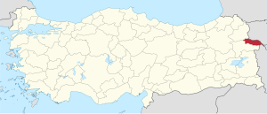
Iğdır ( kurd. Reşqelas ) is a province in eastern Turkey and borders Armenia , the Azerbaijani exclave of Naxçıvan and Iran . Iğdır's neighboring provinces are Kars in the northwest and Ağrı in the south. Its capital is Iğdır . The previous name was Zuraşat.
Iğdır is the only province in Turkey that borders three states. Because of the vegetation, Iğdır is also called Yeşil Iğdır ("Green Iğdır"). Mount Ararat is largely within the boundaries of Iğdır.
Iğdır was founded on May 27, 1992 as the 76th province of Turkey. Before Iğdır belonged to the province of Kars .
geography
Iğdır is at the crossroads of important connecting roads. From here one could reach the commercial center of Erzurum and also Kars. Another road leads to Iran via Doğubayazıt. The 3588 km² large province is characterized by the contrast between the mountain range of the Great and Small Ararat, rising from the Armenian highlands in the south and the valley of the Aras on the border with Armenia. The peaks of the Great and Small Ararat (Turkish: Büyük Ağrı Dağı and Küçük Ağrı Dağı ) are located in the province of Ağrı, which is named after them.
The temperatures can range from a maximum of 40 ° C to a minimum of −30 ° C. It is remarkable that, compared to other places in the Armenian highlands, the amount of precipitation is low (about 250 mm annual mean), which is due to the proximity of the Ararat.
Administrative division
The province is divided into four districts (also districts, İlçe ):
| district | Area 1 (km²) |
Population (2018) 2 | Number of Units | Density (Ew / km²) |
urban share (in%) |
Sex ratio 3 |
Founding date 4.5 |
|||
|---|---|---|---|---|---|---|---|---|---|---|
| District ( İlçe ) | Administrative headquarters (Merkez) |
Municipalities (Belediye) |
City quarter (Mahalle) |
Villages (Köy) |
||||||
| Aralık | 852 | 21,311 | 6,193 | 1 | 5 | 21st | 25.0 | 29.06 | 881 | 1960 |
| Iğdır Merkez | 1,273 | 137,613 | 92,340 | 4th | 24 | 41 | 108.1 | 77.64 | 947 | 1992 |
| Karakoyunlu | 269 | 13,972 | 2,886 | 1 | 2 | 18th | 51.9 | 20.66 | 920 | 1992 |
| Tuzluca | 1,270 | 24,560 | 9,764 | 1 | 5 | 81 | 19.3 | 39.76 | 904 | |
| PROVINCE Iğdır | 3,664 | 197,456 | 7th | 36 | 161 | 53.9 | 63.65 | 933 | ||
swell
population
The population consists of Azerbaijanis , Turks and Kurds .
At the 2011 census, the average age in the province was 22.96 years (national average: 29.60), with the female population being on average 0.48 years older than the male population (23.23-22.75).
Results of the population extrapolation
The following table shows the annual population development at the end of the year after updating by the addressable population register (ADNKS) introduced in 2007. In addition, the population growth rate and the sex ratio (are Sex Ratio h. Number of women per 1,000 men d.) Listed.
The 2011 census found 187,842 inhabitants, over 19,000 more than in the 2000 census.
| year | Population at the end of the year | Population growth rate (in%) |
Gender ratio (women per 1000 men) |
Rank (among 81 provinces) |
||
|---|---|---|---|---|---|---|
| total | male | Female | ||||
| 2018 | 197,456 | 102.171 | 95,285 | 1.38 | 933 | 75 |
| 2017 | 194,775 | 100,268 | 94.507 | 1.03 | 943 | 73 |
| 2016 | 192.785 | 99.057 | 93,728 | 0.18 | 946 | 73 |
| 2015 | 192.435 | 99,099 | 93,336 | 0.20 | 942 | 73 |
| 2014 | 192.056 | 98.908 | 93,148 | 0.86 | 942 | 73 |
| 2013 | 190.424 | 98.008 | 92,416 | 0.01 | 943 | 74 |
| 2012 | 190,409 | 98,537 | 91,872 | 0.82 | 932 | 73 |
| 2011 | 188,857 | 97,770 | 91.087 | 2.41 | 932 | 73 |
| 2010 | 184,418 | 94,443 | 89.975 | 0.51 | 953 | 74 |
| 2009 | 183,486 | 94,611 | 88,875 | −0.29 | 939 | 75 |
| 2008 | 184.025 | 95.195 | 88,830 | 1.19 | 933 | 74 |
| 2007 | 181,866 | 92,732 | 89.134 | - | 961 | 73 |
| 2000 1 | 168,634 | 87,083 | 81,551 | 936 | 76 | |
1 2000 census
Population of the counties
The values from 2000 are based on the census, the remaining (2007-2018) are population figures at the end of the year, determined by updating the population register introduced in 2007 (ADNKS)
| district | 2000 | 2007 | 2008 | 2009 | 2010 | 2011 | 2012 | 2013 | 2014 | 2015 | 2016 | 2017 | 2018 |
|---|---|---|---|---|---|---|---|---|---|---|---|---|---|
| Aralık | 21,747 | 22,155 | 22,165 | 21,674 | 21,810 | 22,425 | 22,521 | 21,881 | 21,843 | 21,495 | 21,269 | 21,461 | 21,311 |
| Merkez | 102,648 | 119,432 | 121,848 | 122,780 | 123,570 | 127,609 | 128,976 | 130.134 | 132.110 | 133,704 | 134,480 | 136.155 | 137,613 |
| Karakoyunlu | 18,285 | 14,597 | 14,273 | 13,990 | 14,042 | 14.054 | 14,264 | 14,016 | 13,929 | 13,686 | 13,634 | 13,953 | 13,972 |
| Tuzluca | 25,954 | 25,682 | 25,739 | 25,042 | 24,996 | 24,769 | 24,648 | 24,393 | 24,174 | 23,550 | 23,402 | 23.206 | 24,560 |
| Toplam | 168,634 | 181,866 | 184.025 | 183,486 | 184,418 | 188,857 | 190,409 | 190.424 | 192.056 | 192.435 | 192.785 | 194,775 | 197,456 |
economy
Despite increasing urbanization, the province is still strongly characterized by agriculture, with sheep breeding being particularly important. Existing industries are e.g. B. Mustaş (commercial transport), the Araş and various workshops for felt and textile machine production and flour mills.
history
In Iğdır, among others, who ruled Mitanni , Hittites , Assyrians , Armenians , Cimmerians , Medes , Persians , Urartu , Scythians , Seleucids , Arsakiden , Sassanids , Arabs , Byzantines , Seljuks , Mongols , Ilchane , Kara Koyunlu , Akkoyunlar , Safavids and the Ottomans . Due to the geographical location, trade with Naxçıvan and Iran has developed, which animates the region.
Here is the Armenian monastery of Saint Hakob von Akori , built in 341, and the Agarak monastery , built in 649 .
Personalities
- Avedis Aharonian , Armenian politician and writer
- Mehmet Aktaş , Kurdish documentary filmmaker and journalist
- Servet Çetin , Turkish-Azerbaijani football player
- Harutjun Hakobjan , Soviet-Armenian illusionist
- Edouard Isabekjan , Armenian-Soviet graphic artist
- Drastamat Kanajan , Armenian military
Web links
Individual evidence
- ↑ Türkiye Nüfusu İl ve İlçelere Göre Nüfus Bilgileri , accessed on April 23, 2019
- ↑ Iğdır Province website (portrait of the governor) , accessed April 23, 2019
- ↑ Directorate General of Mapping İl ve İlçe Yüzölçümleri (PDF; 0.25 MB).
- ↑ Türkiye Nüfusu İl İlçe Mahalle Köy Nüfusu , accessed on April 23, 2019.
- ↑ illeridaresi.gov.tr (PDF; 1.4 MB).
- ↑ 2000 census (Turkish)
- ↑ MDS / Central Dissemination System from TÜIK (Eng./Turk.)
Adana | Adıyaman | Afyonkarahisar | Ağrı | Aksaray | Amasya | Ankara | Antalya | Ardahan | Artvin | Aydın | Balıkesir | Bartın | Batman | Bayburt | Bilecik | Bing oil | Bitlis | Bolu | Burdur | Bursa | Çanakkale | Çankırı | Çorum | Denizli | Diyarbakır | Düzce | Edirne | Elazığ | Erzincan | Erzurum | Eskişehir | Gaziantep | Giresun | Gümüşhane | Hakkâri | Hatay | Iğdır | Isparta | İstanbul | İzmir | Kahramanmaraş | Karabük | Karaman | Kars | Kastamonu | Kayseri | Kırıkkale | Kırklareli | Kırşehir | Kilis | Kocaeli | Konya | Kutahya | Malatya | Manisa | Mardin | Mersin | Muğla | Muş | Nevşehir | Niğde | Ordu | Osmaniye | Rize | Sakarya | Samsun | Siirt | Sinop | Sivas | Şanlıurfa | Şırnak | Tekirdağ | Tokat | Trabzon | Tunceli | Usak | Van | Yalova | Yozgat | Zonguldak