
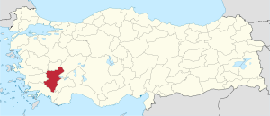
Denizli (province)
| Denizli | |
|---|---|
| Province number: | 20th |
  |
|
| Counties | |
 |
|
| Basic data | |
| Coordinates: | 37 ° 45 ′ N , 29 ° 17 ′ E |
| Provincial capital: | Denizli |
| Region: | Aegean region |
| Surface: | 12,134 km² |
| Population: | 1,027,782 (2018) |
| Population density: | 84.7 inhabitants / km² |
| Political | |
| Governor: | Hasan Karahan |
| Seats in Parliament: | 7th |
| Structural | |
| Post Code: | 20,000 |
| Telephone code: | 0258 |
| Features : | 20th |
| Website | |
| www.denizli.gov.tr (Turkish) | |
Denizli is a Turkish province in western Asia Minor with an area of 12,134 km² and a population of 1,005,687 inhabitants (as of 2016). The population and area of the city of Denizli is identical to that of the province of Denizli.
The provincial and city license plates start with the number 20.
geography
The province is bordered to the north by Manisa and Uşak , to the east by Afyonkarahisar and Burdur , to the south by Muğla and to the west by Aydın . The landscape is particularly characterized by mountains. There are eight mountains that are over 2000 m high and five mountains that are over 1000 m high. The highest is the Honaz Dağı , which is 2528 m high, followed by the peaks Akdağ (2449 m), Bozdağ (2419 m), Babadağ (2308 m), Karcı Dağı (2308 m), Sandıras Dağı (2294 m), Eşeler Dağı (2254 m) and Kızılhisar Dağı (2241 m). The highest one-thousand- meter peak is Beşparmak Dağı (1,612 m).
The province of Denizli is dominated by the wide valley of the Great Meander (Turkish: Büyuk Menderes ), which has a distinctive valley fork with three tributaries near Denizli. The upper reaches of the Great Meander there formed the transition area between the earlier empires (or provinces) of Phrygia and Caria in ancient Asia Minor .
The European route E87 and a similar railway line run through the province . The E87 runs from Izmir via Aydın and Denizli to Antalya .
The Denizli Çardak Airport is a national commercial airport. In 2008 a new terminal opened and the rest of the airport was renewed and modernized.
climate
In general, the region has a mild climate. However, it gets rougher at higher altitudes. Temperatures can reach 45˚C in summer and drop to -10˚C in winter. There are approximately 80 days of rainfall, mostly during winter.
Administrative division
The province has been divided into 19 İlçe since 2012 , which resemble a district in terms of settlement in rural areas and a district in urban agglomerations. In 2012, the old Denizli community was dissolved and a large city community ( Denizli Büyükşehir Belediyesi ) was established in its place . For this purpose, the old urban area was divided into several municipalities ( Belediye ) and with these and neighboring municipalities, the metropolitan municipality was formed. Successive was set up and dissolution of municipalities and overpasses of village ( Köy ) in Mahalle organizations a Einräumigkeit manufactured by local administration (by the Belediye) and state management (by the İlçe), so that as a result, the area of the individual communities with the each state administrative district of the same name covers. Following an administrative reform in 2013, the metropolitan area covers the entire province. The municipal self-government organs at provincial level ( İl Meclisi ) were dissolved and their responsibilities were transferred to the administration of the metropolitan municipality. The province thus became a purely state administrative district.
| İlçe | Area in km² 1 |
Population 2 | Number of mahalles |
Population density (inh. Per km²) |
Sex ratio women to 1000 men 3 |
Founding date 4.5 |
||
|---|---|---|---|---|---|---|---|---|
| total | male | Female | ||||||
| Acıpayam | 1,772 | 55,648 | 27,934 | 27,714 | 56 | 31.4 | 992 | |
| Babadağ | 124 | 6,522 | 3,358 | 3.164 | 12 | 52.6 | 942 | 1987 |
| Baklan | 283 | 5,654 | 2,800 | 2,854 | 14th | 20.0 | 1019 | 1990 |
| Bekilli | 304 | 7,065 | 3,349 | 3,716 | 15th | 23.2 | 1110 | 1987 |
| Beyağaç | 333 | 6,903 | 3,536 | 3,367 | 15th | 20.7 | 952 | 1990 |
| Bozkurt | 462 | 12,788 | 5,719 | 7,069 | 20th | 27.7 | 1236 | 1990 |
| Buldan | 523 | 27,241 | 13,264 | 13,977 | 45 | 52.1 | 1054 | |
| Çal | 860 | 19,259 | 9,485 | 9,774 | 34 | 22.4 | 1030 | |
| Çameli | 758 | 18,256 | 9,190 | 9,066 | 31 | 24.1 | 987 | 1953 |
| Çardak | 423 | 9,144 | 4,715 | 4,429 | 15th | 21.6 | 939 | 1958 |
| Çivril | 1,570 | 60,429 | 29,896 | 30,533 | 77 | 38.5 | 1021 | |
| Güney | 362 | 9,975 | 4,940 | 5,035 | 24 | 27.6 | 1019 | 1948 |
| Honaz | 449 | 33.184 | 18,228 | 14,956 | 23 | 73.9 | 820 | 1987 |
| Kale | 684 | 20,393 | 10.168 | 10,225 | 32 | 29.8 | 1006 | 1959 |
| Merkezefendi | 336 | 302.213 | 149,611 | 152.602 | 50 | 899.4 | 1020 | 2012 |
| Pamukkale | 823 | 344.065 | 171,568 | 172.497 | 61 | 418.1 | 1005 | 1990 |
| Saraykoy | 379 | 30,768 | 15,518 | 15,250 | 32 | 81.2 | 983 | |
| Serinhisar | 256 | 14,430 | 7.156 | 7,274 | 11 | 56.4 | 1016 | 1987 |
| Tavas | 1,432 | 43,845 | 21,674 | 22,171 | 50 | 30.6 | 1023 | |
| Denizli Province | 12.134 | 1,027,782 | 512.109 | 515,673 | 617 | 84.7 | 1007 | |
- swell
population
The majority of the population in the province is Muslim . There are also Alevis in Ada , Çalçakırlar , Dereçiftlik , Güzelköy , Kızılyer , Kocabaş , Pınarkent , Uyanık and Yeniköy . In addition, the two localities Hayriye and Sığma are resident of Circassians .
Results of the population extrapolation
The following table shows the annual population development after updating by the addressable population register (ADNKS) introduced in 2007. In addition, (the population growth rate and gender relations are sex ratio , the number of women per 1,000 men mathematically determined d. H.) Listed. The 2011 census determined 940,352 inhabitants, which is over 90,000 more than in the 2000 census.
| year | Population at the end of the year | Population growth rate (in%) |
Gender ratio (women per 1000 men) |
Rank (among 81 provinces) |
||
|---|---|---|---|---|---|---|
| total | male | Female | ||||
| 2018 | 1,027,782 | 512.109 | 515,673 | 0.89 | 1007 | 22nd |
| 2017 | 1,018,735 | 507,543 | 511.192 | 1.30 | 1007 | 21st |
| 2016 | 1,005,687 | 500,398 | 505.289 | 1.23 | 1010 | 21st |
| 2015 | 993.442 | 494,808 | 498,634 | 1.51 | 1008 | 21st |
| 2014 | 978,700 | 487,958 | 490.742 | 1.58 | 1006 | 21st |
| 2013 | 963.464 | 480.224 | 483.240 | 1.36 | 1006 | 21st |
| 2012 | 950,557 | 473.041 | 477,516 | 0.88 | 1009 | 21st |
| 2011 | 942.278 | 470.027 | 472.251 | 1.12 | 1005 | 21st |
| 2010 | 931,823 | 464.104 | 467.719 | 0.59 | 1008 | 21st |
| 2009 | 926,362 | 462.914 | 463,448 | 0.93 | 1001 | 21st |
| 2008 | 917.836 | 458.787 | 459.049 | 1.16 | 1001 | 21st |
| 2007 | 907.325 | 453.756 | 453,569 | - | 1000 | 21st |
| 2000 | 850.029 | 426.179 | 423,850 | 995 | 25th | |
Census results
The following tables show the population of Denizli province documented in the 15 censuses . The values in the table on the left come from e-books (from the original documents), the values in the table on the right are based on the data query from the Turkish statistical institute TÜIK
| year | Population on censor day |
Share in% |
rank | |
|---|---|---|---|---|
| Turkey | Denizli Province | |||
| 1927 | 13,648,270 | 243.812 | 1.79 | 21st |
| 1935 | 16.158.018 | 285.918 | 1.77 | 22nd |
| 1940 | 17,820,950 | 285.225 | 1.60 | 26th |
| 1945 | 18,790,174 | 315.934 | 1.68 | 24 |
| 1950 | 20,947,188 | 340.277 | 1.62 | 24 |
| 1955 | 24,064,763 | 368.294 | 1.53 | 24 |
| 1960 | 27,754,820 | 425,449 | 1.53 | 25th |
| year | Population on censor day |
Share in% |
rank | |
|---|---|---|---|---|
| Turkey | Denizli Province | |||
| 1965 | 31,391,421 | 463.369 | 1.48 | 26th |
| 1970 | 35.605.176 | 511.160 | 1.44 | 28 |
| 1975 | 40,347,719 | 560.916 | 1.39 | 28 |
| 1980 | 44,736,957 | 603,338 | 1.35 | 26th |
| 1985 | 50,664,458 | 667.478 | 1.32 | 27 |
| 1990 | 56.473.035 | 750,882 | 1.33 | 25th |
| 2000 | 67,803,927 | 850.029 | 1.25 | 25th |
| 2011 | 74,525,696 | 940.532 | 1.26 | 21st |
Number of provinces in relation to the census years:
- 1927, 1940 to 1950: 63 provinces
- 1935: 57 provinces
- 1955: 67 provinces
- 1960 to 1985: 73 provinces
- 1990: 73 provinces
- 2000: 81 provinces
Detailed census results
| year | Total population | Urban population | Rural population | |||||||
|---|---|---|---|---|---|---|---|---|---|---|
| total | male | Female | total | male | Female | total | male | Female | ||
| 1927 | 243.812 | 110,702 | 133.110 | 41.209 | 20.171 | 21,038 | 202.603 | 90,531 | 112,072 | |
| 1935 | 285.918 | 132,822 | 153.096 | 43,866 | 20,944 | 22,922 | 242.052 | 111,878 | 130.174 | |
| 1940 | 285.225 | 132.923 | 152.302 | 47,619 | 23,264 | 24,355 | 237,606 | 109,659 | 127,947 | |
| 1945 | 315.934 | 150.139 | 165.795 | 51,251 | 25,028 | 26,223 | 264,683 | 125.111 | 139,572 | |
| 1950 | 340.277 | 163,679 | 176,598 | 61,297 | 30,552 | 30,745 | 278.980 | 133.127 | 145.853 | |
| 1955 | 368.294 | 179,342 | 188,952 | 72,170 | 36,699 | 35,471 | 296.124 | 142,643 | 153,481 | |
| 1960 | 425,449 | 211.121 | 214,328 | 100,916 | 54,177 | 46,739 | 324,533 | 156.944 | 167,589 | |
| 1965 | 463.369 | 230,468 | 232.901 | 117,739 | 62,881 | 54,858 | 345,630 | 167,587 | 178.043 | |
| 1970 | 511.160 | 250.178 | 260,982 | 141,309 | 74,765 | 66,544 | 369.851 | 175.413 | 194,438 | |
| 1975 | 560.916 | 281.186 | 279.730 | 171,586 | 90,562 | 81.024 | 389.330 | 190.624 | 198,706 | |
| 1980 | 603,338 | 298,426 | 304.912 | 205.938 | 107,747 | 98.191 | 397,400 | 190,679 | 206.721 | |
| 1985 | 667.478 | 335.364 | 332.114 | 248,673 | 130.415 | 118.258 | 418,805 | 204,949 | 213.856 | |
| 1990 | 750,882 | 379.129 | 371.753 | 337.793 | 175.039 | 162,754 | 413.089 | 204.090 | 208,999 | |
| 2000 | 850.029 | 426.179 | 423,850 | 413.914 | 208,675 | 205.239 | 436.115 | 217.504 | 218.611 | |
| 2011 | 940.532 | detailed information is missing | ||||||||
Culture and sights

The main tourist attraction in the province is Pamukkale ( Turkish for cotton castle ). Near this small town north of the river valley, a series of impressive limestone terraces have formed through limestone deposits from abundant thermal springs .
These terraces on the slope of the mountain Çökelez are on the UNESCO the list World Heritage Site ; Until a few years ago you could bathe in them. The exiting water is 35 ° C and has a pH of 6.
The nearby Hierapolis ( Greek for Holy City ) is another attraction. The ancient site has an extensive, well-preserved necropolis with various types of graves. You can also see a large theater for 15,000 people, the Temple of Apollo , the Plutonium, the Philippus Church as well as the city wall, baths and grammar school.
Some of the seven communities of early Christianity are also located in the province , including Laodikeia on Lykos and the ancient city of Kolossai in the highlands near Honaz . The apostle Paul wrote one of his letters to the church there around the year 60.
Remains of the ancient city of Tripoli can be found near the village of Yenice.
Other sights are the caravanserais of Akhan and Çardak and the settlement mound of Beycesultan with its excavations .
economy
The province and the city of Denizli in Turkey for the Denizli-Kräher ( Turkish Denizli Horozu famous) called taps. The Denizli Crow, together with the limestone terraces of Pamukkale, are the landmarks of the province. This breed is one of the oldest long crane breeds in the world. The typical Denizli rooster has black eyes, dark gray legs, a long neck and a red crest. It weighs 3 to 3.5 kg and has a characteristic crows.
Wine is grown in the province and there is a textile industry.
Personalities
See also: List of sons and daughters of the city of Denizli
- Baki Adam , religious scholar and writer
- Kadir Akbulut , soccer player
- Sezen Aksu , singer
- Emin Haluk Ayhan , politician and member of parliament for the MHP
- Bülent Ertuğrul , football player
- Sıla Gençoğlu , singer
- Hasan Güngör , wrestler
- Recep Niyaz , soccer player
- Bayram Şit , wrestler
- Yusuf Tavaslı , writer
- Muhittin Tekin , soccer player
- Hasan Ali Toptaş , writer
- Hüseyin Yılmaz , physicist
- Nihat Zeybekçi , entrepreneur and politician
- Hacı Mehmet Zorlu , entrepreneur
- Ahmet Nazif Zorlu , entrepreneur
Web links
Individual evidence
- ↑ Nufusu.com , accessed September 10, 2019
- ↑ Governor's portrait on the Denizli Province website
- ↑ Directorate General of Mapping İl ve İlçe Yüzölçümleri (PDF; 0.25 MB).
- ↑ Türkiye Nüfusu İl İlçe Mahalle Köy Nüfusu , accessed on October 1, 2019 (Turkish).
- ↑ illeridaresi.gov.tr (PDF; 1.4 MB).
- ↑ Tokat Nüfusu , accessed on 1 October 2019
- ^ Library of the Turkish Statistics Institute TÜIK , available after entering search data
- ↑ Genel Nüfus Sayımları (census results 1965 to 2000) available after selecting the year and region
Adana | Adıyaman | Afyonkarahisar | Ağrı | Aksaray | Amasya | Ankara | Antalya | Ardahan | Artvin | Aydın | Balıkesir | Bartın | Batman | Bayburt | Bilecik | Bing oil | Bitlis | Bolu | Burdur | Bursa | Çanakkale | Çankırı | Çorum | Denizli | Diyarbakır | Düzce | Edirne | Elazığ | Erzincan | Erzurum | Eskişehir | Gaziantep | Giresun | Gümüşhane | Hakkâri | Hatay | Iğdır | Isparta | İstanbul | İzmir | Kahramanmaraş | Karabük | Karaman | Kars | Kastamonu | Kayseri | Kırıkkale | Kırklareli | Kırşehir | Kilis | Kocaeli | Konya | Kutahya | Malatya | Manisa | Mardin | Mersin | Muğla | Muş | Nevşehir | Niğde | Ordu | Osmaniye | Rize | Sakarya | Samsun | Siirt | Sinop | Sivas | Şanlıurfa | Şırnak | Tekirdağ | Tokat | Trabzon | Tunceli | Usak | Van | Yalova | Yozgat | Zonguldak