
Niğde (Province)
| Niğde | |
|---|---|
| Province number: | 51 |
  |
|
| Counties | |
 |
|
| Basic data | |
| Coordinates: | 37 ° 55 ' N , 34 ° 42' E |
| Provincial capital: | Niğde |
| Region: | Central Anatolia |
| Surface: | 7,235 km² |
| Population: | 364,707 (2018) |
| Population density: | 50.4 inhabitants / km² |
| Political | |
| Governor: | Yılmaz Şimşek |
| Seats in Parliament: | 3 |
| Structural | |
| Telephone code: | 0388 |
| Features : | 51 |
| Website | |
| www.nigde.gov.tr (Turkish) | |
Niğde is a small, rural province of Turkey in central Anatolia on the southern edge of Cappadocia . Their capital is Niğde of the same name .
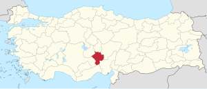
The province borders on the provinces of Kayseri in the east, Adana in the southeast, Mersin in the south, Konya in the west, Aksaray in the northwest and Nevşehir in the north. From the center of the state capital Ankara to Niğde it is about 270 km as the crow flies in a south-easterly direction.
The population density is 50 inhabitants / km². The license plate number is 51.
geography
Niğde is surrounded on three sides by the Taurus Mountains with the Hasan Dağı (Mount Hasan) and the Melendiz Çayı River. To the west is the plain of Emen (town in the Beyşehir district in Konya province ), which opens into the wide plain of Konya. Fertile volcanic soils are the basis of productive agriculture. Mainly apples and potatoes are grown.
Due to the altitude and the mountains, the province has a dry and cold climate with snow and cold north winds in winter, with practically no rainfall in summer.
Administrative division
The province is divided into six districts ( İlçe ) :
| district | Area 1 (km²) |
Population (2018) 2 | Number of Units | Density (Ew / km²) |
urban share (in%) |
Sex ratio 3 |
Founding date 4.5 |
|||
|---|---|---|---|---|---|---|---|---|---|---|
| District ( İlçe ) | Administrative headquarters (Merkez) |
Municipalities (Belediye) |
City quarter (Mahalle) |
Villages (Köy) |
||||||
| Altunhisar | 552 | 15,463 | 3,406 | 3 | 11 | 6th | 28.0 | 68.82 | 929 | 1990 |
| boron | 1,522 | 60,335 | 40,498 | 4th | 32 | 23 | 39.6 | 83.84 | 1015 | |
| Çamardı | 1,163 | 13,200 | 3,627 | 1 | 4th | 21st | 11.3 | 27.48 | 1026 | 1948 |
| Çiftlik | 400 | 28,168 | 4,771 | 4th | 15th | 9 | 70.4 | 62.03 | 940 | 1990 |
| Merkez Niğde | 2.223 | 224.289 | 150.178 | 16 | 69 | 34 | 100.9 | 89.02 | 996 | |
| Ulukışla | 1,375 | 23,252 | 7,395 | 1 | 8th | 38 | 16.9 | 31.80 | 981 | |
| PROVINCE Niğde | 7,235 | 364,707 | 29 | 139 | 131 | 50.4 | 79.34 | 992 | ||
swell
1 Area 2014
2 Population update on December 31, 2018
3 Gender ratio : number of women per 1000 men (calculated)
4 PDF file of the Ministry of the Interior
5 districts that were only formed after Turkey was founded (1923).
population
Results of the population extrapolation
The following table shows the annual population development after updating by the addressable population register (ADNKS) introduced in 2007. In addition, the population growth rate and sex ratio are ( Sex Ratio listed ie number of women per 1,000 men). The 2011 census determined 337,456 inhabitants, which is over 10,000 inhabitants less than the 2000 census.
| year | Population at the end of the year | Population growth rate (in%) |
Gender ratio (women per 1000 men) |
Rank (among 81 provinces) |
||
|---|---|---|---|---|---|---|
| total | male | Female | ||||
| 2018 | 364,707 | 183.109 | 181,598 | 3.40 | 992 | 53 |
| 2017 | 352,727 | 176.194 | 176,533 | 0.36 | 1002 | 54 |
| 2016 | 351,468 | 175,571 | 175,897 | 1.55 | 1002 | 54 |
| 2015 | 346.114 | 172,643 | 173.471 | 0.64 | 1005 | 54 |
| 2014 | 343,898 | 171,934 | 171.964 | 0.07 | 1000 | 53 |
| 2013 | 343,658 | 171,750 | 171.908 | 1.00 | 1001 | 53 |
| 2012 | 340.270 | 170.075 | 170.195 | 0.80 | 1001 | 54 |
| 2011 | 337,553 | 168.125 | 169,428 | −0.11 | 1008 | 54 |
| 2010 | 337.931 | 167,551 | 170.380 | −0.59 | 1017 | 53 |
| 2009 | 339.921 | 169.704 | 170.217 | 0.44 | 1003 | 51 |
| 2008 | 338,447 | 169.377 | 169.070 | 2.04 | 998 | 51 |
| 2007 | 331,677 | 164,745 | 166.932 | - | 1013 | 53 |
| 2000 | 348.081 | 172,367 | 175.714 | 1019 | 55 | |
Census results
The following tables show the population of Niğde Province documented in the 14 censuses .
The values in the table on the left are taken from e-books (from the original documents), the values in the table on the right come from the data query of the Turkish statistical institute TÜIK - available on this website:
| year | population | rank | |
|---|---|---|---|
| province | Turkey | ||
| 1927 | 166.056 | 13,648,270 | 39 |
| 1935 | 247.376 | 16.158.018 | 32 |
| 1940 | 275,443 | 17,820,950 | 30th |
| 1945 | 296,584 | 18,790,174 | 26th |
| 1950 | 331,470 | 20,947,188 | 26th |
| 1955 | 284,563 | 24,064,763 | 39 |
| 1960 | 322.917 | 27,754,820 | 39 |
| year | population | rank | |
|---|---|---|---|
| province | Turkey | ||
| 1965 | 362,444 | 31,391,421 | 38 |
| 1970 | 408,441 | 35.605.176 | 37 |
| 1975 | 463.121 | 40,347,719 | 37 |
| 1980 | 512.071 | 44,736,957 | 34 |
| 1985 | 560.386 | 50,664,458 | 34 |
| 1990 | 305,861 | 56.473.035 | 56 |
| 2000 | 348.081 | 67,803,927 | 55 |
Number of provinces in relation to the census years:
- 1927, 1940 to 1950: 63 provinces
- 1935: 57 provinces
- 1955: 67 provinces
- 1960 to 1985: 73 provinces
- 1990: 73 provinces
- 2000: 81 provinces
Communities
There are 23 municipalities ( Belediye ) in the province with over 2000 inhabitants. In addition to the six district towns (see table " Administrative structure ", column Merkez ) there are the following 23 places:
| Belediye | district | Population 2018 |
|---|---|---|
| Yeşilgölcük | Merkez | 5,475 |
| Edikli | Merkez | 5,393 |
| Kiledere | Merkez | 5,353 |
| Kemerhisar | boron | 5,264 |
| Bozkoy | Çiftlik | 4,511 |
| Divarlı | Çiftlik | 4,109 |
| Azatlı | Çiftlik | 4,081 |
| Karakapı | Altunhisar | 3,966 |
| Sazlıca | Merkez | 3,771 |
| Karaatlı | Merkez | 3,519 |
| Alay | Merkez | 3,360 |
| Orhanlı | Merkez | 3,336 |
| Belediye | district | Population 2018 |
|---|---|---|
| Keçikalesi | Altunhisar | 3,269 |
| Konaklı | Merkez | 3,265 |
| Dündarlı | Merkez | 2,728 |
| Çukurkuyu | boron | 2,635 |
| Baglama | Merkez | 2,359 |
| Hacıabdullah | Merkez | 2,281 |
| Aktaş | Merkez | 2,257 |
| Bahçeli | boron | 2,186 |
| Gümüşler | Merkez | 2.148 |
| Değirmli | Merkez | 2.132 |
| Yıldıztepe | Merkez | 2,101 |
history
The area has been known since the Neolithic Age 8,000–5,500 BC. It was inhabited by excavations of burial mounds in Bor district and tin mines in Çamardı-Keste district. The Hittites later settled there for about 1000 years until 800 BC. Chr.
The name Niğde developed from the ancient Nakita or Nahita and was first mentioned as na-hi-ti-ia in a Luwian inscription of King Saruanis found in Andaval . Then came the Assyrians and Phrygians , Greeks , Persians , Alexander the Great and the Romans , who built the city of Tyana with its palaces and fountains near today's Kemerhisar .
Roman rule or the Byzantine Empire lasted until the Seljuks conquered it in 1166. Niğde was one of the largest cities in Anatolia until the beginning of the 13th century, and an impressive number of mosques and tombs date from this period. The area belonged to the Ottoman Empire since 1471 and to the Turkish Republic from 1923 .
economy
Niğde benefits from lush agriculture (the apples are especially famous) and its location between the affluent provinces of Konya in central Anatolia and Adana on the Mediterranean. The tourist attractions of Cappadocia and the Kayseri and Nevşehir airports are nearby.
Like apples, potatoes, cabbage, grain and beetroot are important agricultural goods. There is also dairy and meat production, as well as beekeeping and more and more fish farms.
traffic
The O.21 motorway begins north of Niğde and leads south in three lanes to Tarsus on the Mediterranean Sea. The route north to Ankara is being planned or built. The European route E 90 follows this motorway.
Otherwise the district is crossed by the following highways. Niğde is partly the end point of some highways:
- The D765 trunk road leads from Inebolu on the Black Sea, 512 km south to Niğde.
- The D750 trunk road runs south from Zonguldak on the Black Sea to Tarsus on the Mediterranean.
- A section of the trunk road D330 ends from Bodrum on the Aegean Sea (eastward) in Niğde.
- The D805 trunk road ends after 367 km from the north ( Zile , Tokat province) in Ulukışla near Niğde.
Niğde is a railway station on the line that runs south from Kayseri to Ulukışla, where it meets the Karaman - Adana line .
Attractions
The mountains Aladağ and Bolkar in the Taurus Mountains are well-known winter sports areas and popular climbing and trekking areas in summer. Aladağ has one of the most popular climbing routes that can be reached from the villages of Demirkazık and Çukurbağ in Çamardı . The Bolkar has a seven kilometer long ski slope, a crater lake and is known for its abundant flowers in spring.
In Niğde there are many old churches, mosques and underground cities built into the rocks, including Eski Gümüş , the ancient city of Tyana and some Roman aqueducts in the Bor district. The Niğde Archaeological Museum is located in the capital . There are also warm mineral springs. In the village of Küçükköy , about eight kilometers northwest of the capital, lies the church of Küçükköy with partially preserved frescoes. In the south of the Altunhisar district lies the settlement hill Kınık Höyük , which was inhabited from the Bronze Age to the Middle Ages and contains the remains of a citadel from the late Hittite period.
Web links
Individual evidence
- ↑ Türkiye Nüfusu İl ve İlçelere Göre Nüfus Bilgileri , accessed on July 14, 2019
- ^ Portrait of the governor on the Niğde Province website
- ↑ Directorate General of Mapping İl ve İlçe Yüzölçümleri (PDF file 0.25 MB)
- ↑ Türkiye Nüfusu İl İlçe Mahalle Köy Nüfusu , accessed on July 14, 2019
- ↑ [1] TARİH (1) .pdf 1.4 MB
- ↑ Genel Nüfus Sayımları (census results 1965 to 2000)
- ↑ Yellow , Hittite hieroglyphs II 1935 pp. 17-18
Adana | Adıyaman | Afyonkarahisar | Ağrı | Aksaray | Amasya | Ankara | Antalya | Ardahan | Artvin | Aydın | Balıkesir | Bartın | Batman | Bayburt | Bilecik | Bing oil | Bitlis | Bolu | Burdur | Bursa | Çanakkale | Çankırı | Çorum | Denizli | Diyarbakır | Düzce | Edirne | Elazığ | Erzincan | Erzurum | Eskişehir | Gaziantep | Giresun | Gümüşhane | Hakkâri | Hatay | Iğdır | Isparta | İstanbul | İzmir | Kahramanmaraş | Karabük | Karaman | Kars | Kastamonu | Kayseri | Kırıkkale | Kırklareli | Kırşehir | Kilis | Kocaeli | Konya | Kutahya | Malatya | Manisa | Mardin | Mersin | Muğla | Muş | Nevşehir | Niğde | Ordu | Osmaniye | Rize | Sakarya | Samsun | Siirt | Sinop | Sivas | Şanlıurfa | Şırnak | Tekirdağ | Tokat | Trabzon | Tunceli | Usak | Van | Yalova | Yozgat | Zonguldak