
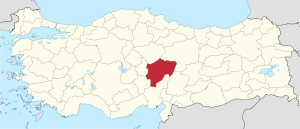
Kayseri (Province)
| Kayseri | |
|---|---|
| Province number: | 38 |
  |
|
| Counties | |
 |
|
| Basic data | |
| Coordinates: | 38 ° 38 ′ N , 35 ° 50 ′ E |
| Provincial capital: | Kayseri |
| Region: | Central Anatolia |
| Surface: | 17,170 km² |
| Population: | 1,358,980 (2016) |
| Population density: | 79 inhabitants / km² |
| Political | |
| Governor: | Suleyman Kamçı |
| Seats in Parliament: | 9 |
| Structural | |
| Telephone code: | 0352 |
| Features : | 38 |
| Website | |
| www.kayseri.gov.tr (Turkish) | |
Kayseri is a province of Turkey . Their capital is Kayseri .
The province has 1,358,980 inhabitants (as of 2016) on an area of 17,170 km². It has a population density of around 79 inhabitants / km². It borders the provinces of Sivas , Adana , Niğde , Kahramanmaraş , Yozgat and Nevşehir .
Counties
Kayseri has been a major city (Büyükşehir belediyesi) since 1988. After an administrative reform in 2014, all districts are directly subordinate to the Lord Mayor of Kayseri. The former mayors of the municipalities ( Belediye ) were downgraded to the rank of Muhtar . Therefore the 16 counties are also urban districts. 85% of the population live in the city and 15% in the countryside, in a total of 425 villages.
| district | Area [km ^ 2] | Proportion of [%] | Residents | Distance to city | founding year | Altitude [m] | Communities | Villages | location |
|---|---|---|---|---|---|---|---|---|---|
| Akkışla | 546 | 3.26 | 3265 | 79 | 1987 | 1330 | 3 | 5 | northeast |
| Bünyan | 1358 | 8.11 | 12510 | 41 | 1895 | 1358 | 9 | 25th | east |
| Develi | 1887 | 11.28 | 35084 | 40 | 1870 | 1330 | 5 | 45 | southern |
| Felahiye | 412 | 2.46 | 6105 | 58 | 1957 | 1330 | 3 | 9 | north |
| Hacılar | 208 | 1.24 | 19915 | 11 | 1990 | 1350 | 1 | 2 | southern |
| Incesu | 872 | 5.21 | 8511 | 33 | 1901 | 1330 | 3 | 8th | southwest |
| Kocasinan | 1452 | 8.68 | 368356 | 0 | 1989 | 1452 | 10 | 20th | north |
| Melikgazi | 454 | 2.71 | 395003 | 0 | 1989 | 1330 | 8th | 1 | southern |
| Özvatan | 320 | 1.91 | 7105 | 74 | 1990 | 1330 | 2 | 4th | north |
| Pınarbaşı | 3383 | 20.21 | 12075 | 91 | 1861 | 1330 | 3 | 115 | east |
| Sarıoğlan | 599 | 3.58 | 5242 | 61 | 1960 | 1330 | 6th | 18th | northeast |
| Sarız | 1220 | 7.29 | 4404 | 128 | 1946 | 1330 | 2 | 35 | east |
| Talas | 329 | 1.97 | 34879 | 6th | 1987 | 1330 | 6th | 12 | southern |
| Tomarza | 1485 | 8.87 | 10963 | 55 | 1953 | 1330 | 3 | 46 | southeast |
| Yahyalı | 1225 | 7.32 | 22665 | 87 | 1954 | 1210 | 2 | 28 | southern |
| Yeşilhisar | 986 | 5.89 | 13586 | 66 | 1947 | 1330 | 1 | 21st | southwest |
| total | 16736 | 100 | 959668 |
Source: Provincial website
landscape
With an altitude of 3916 m, the Erciyes Dağı is the highest mountain in the province. It offers space for mountaineering and winter tourism. Other mountains are the Aladağ (3,735 m) to the southwest and the Dumanlı Dağları (3,024 m) west of Sariz. The most important lakes are the Camız Gölü, Çöl Gölü, Sarıgöl, Yay Gölü and the Tuzla Gölü, which is also used for salt extraction. There are also dams and ponds. In 2005 the Yamula Baraji (reservoir) was completed, which covers an area of 85 km² and is therefore the largest in the province. The main river is the Kızılırmak. It crosses the province with a length of 128 km. Tributaries are the Sarımsaklı (55.km), Kestuvan (48 km) and the Değirmendere (32 km). The plains include the Develi (1,050 km²), Sarımsaklı (300 km²), Karasaz (80 km²) and the Palas plain (50 km²). The province consists largely of steppe landscape, in a few areas it is forested. The forest cover consists of larch, spruce, fir and oak. 40% of the land area is used as arable land. 40% are pasture, 6% forest.

Attempts to approach a forest

Yamula Baraji (reservoir)

Level in front of the Erciyes Dagi
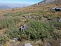
Typical landscape

Typical landscape


.JPG)
Dams
| Surname | location | Lock type | flow | purpose | construction time | Height [m] | Storage space [hm ^ 3] | Water surface [km ^ 2] | Irrigation area [ha] | Power plant output [MW] | Annually Power plant output [GWh] |
|---|---|---|---|---|---|---|---|---|---|---|---|
| Ağcaşar Barajı | Yahyalı | Embankment | Yahyalı | irrigation | 1979-1987 | 30th | 66 | 4th | 15500 | ||
| Akköy Barajı | Yeşilhisar | Rock + embankment | Asarcık | Irrigation + flooding | 1964-1967 | 42 | 8th | 1 | 926 | ||
| Kovalı Barajı | Yeşilhisar | Embankment | Dündarlı | irrigation | 1983-1987 | 45 | 25th | 2 | 3317 | ||
| Sarımsaklı Barajı | Kayseri | Embankment | Sarımsaklı | Irrigation + flooding | 1966-1968 | 40 | 2 | 3.2 | 6400 | ||
| Bahçelik Barajı | Pınarbaşı | Embankment | Zamantı | Irrigation + flooding + energy + drinking water | 1996-2002 | 65 | 216 | 12 | 36282 | 7th | 35 |
| Sarıoğlan Barajı | Sarıoğlan | Embankment | Kestuvan and Düzencik | irrigation | 1990-2002 | 31 | 25th | 3 | 6123 | ||
| Yamula Barajı | Kayseri | rock | Kızılırmak | Irrigation + energy | 2005 | 120 | 2025 | 85 | 100 | 422 | |
| Şeyhli Barajı | Kayseri | Embankment | Bülbülcük | irrigation | 1973 | 22nd | 1440 | 290 | 220 | ||
| Tekir Barajı | Kayseri | Embankment | snow | irrigation | 1991 | 20th | 2750 | 700 | 372 | ||
| Zincidere Barajı | Kayseri | Embankment | Zincidere | irrigation | 1976 | 19th | 178 | 28 | 15th |
Source: Devlet Su İşleri Genel Müdürlüğü
Personalities
- Mimar Sinan † July 17, 1588, Ottoman architect
- Latife Tekin , writer and screenwriter
Individual evidence
- ↑ Turkish Institute for Statistics , accessed December 24, 2017
- ^ Website of the Kayseri Province
- ^ Provincial website
- ↑ Turkey Water Authority , accessed December 20, 2011
Adana | Adıyaman | Afyonkarahisar | Ağrı | Aksaray | Amasya | Ankara | Antalya | Ardahan | Artvin | Aydın | Balıkesir | Bartın | Batman | Bayburt | Bilecik | Bing oil | Bitlis | Bolu | Burdur | Bursa | Çanakkale | Çankırı | Çorum | Denizli | Diyarbakır | Düzce | Edirne | Elazığ | Erzincan | Erzurum | Eskişehir | Gaziantep | Giresun | Gümüşhane | Hakkâri | Hatay | Iğdır | Isparta | İstanbul | İzmir | Kahramanmaraş | Karabük | Karaman | Kars | Kastamonu | Kayseri | Kırıkkale | Kırklareli | Kırşehir | Kilis | Kocaeli | Konya | Kutahya | Malatya | Manisa | Mardin | Mersin | Muğla | Muş | Nevşehir | Niğde | Ordu | Osmaniye | Rize | Sakarya | Samsun | Siirt | Sinop | Sivas | Şanlıurfa | Şırnak | Tekirdağ | Tokat | Trabzon | Tunceli | Usak | Van | Yalova | Yozgat | Zonguldak