
Burdur (province)
| Burdur | |
|---|---|
| Province number: | 15th |
  |
|
| Counties | |
 |
|
| Basic data | |
| Coordinates: | 37 ° 25 ' N , 30 ° 5' E |
| Provincial capital: | Burdur |
| Region: | Mediterranean region |
| Surface: | 7,175 km² |
| Population: | 269,926 (2018) |
| Population density: | 38 inhabitants / km² |
| Political | |
| Governor: | Hasan Şıldak |
| Seats in Parliament: | 3 |
| Structural | |
| Telephone code: | 0248 |
| Features : | 15th |
| Website | |
| www.burdur.gov.tr (Turkish) | |
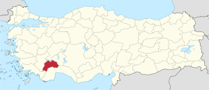
Burdur is a province of Turkey . Their capital is Burdur .
The province has 269,926 inhabitants on an area of 7,175 km² (as of the end of 2018). It borders on the provinces of Antalya , Denizli , Afyonkarahisar , Isparta and Muğla .
population
Results of the population extrapolation
The following table shows the annual population development at the end of the year after updating by the addressable population register (ADNKS) introduced in 2007. In addition, the population growth rate and are gender relations ( sex ratio h. Number of women per 1,000 men d.) Listed.
The 2011 census determined 250,984 inhabitants, which is almost 6,000 fewer than in the 2000 census.
| year | Population at the end of the year | Population growth rate (in%) |
Gender ratio (women per 1000 men) |
Rank (among 81 provinces) |
||
|---|---|---|---|---|---|---|
| total | male | Female | ||||
| 2018 | 269,926 | 135,240 | 134,686 | 1.94 | 996 | 65 |
| 2017 | 264,779 | 133.026 | 131,753 | 1.29 | 990 | 65 |
| 2016 | 261,401 | 130,082 | 131,319 | 1.19 | 1010 | 65 |
| 2015 | 258,339 | 128.049 | 130,290 | 0.56 | 1018 | 65 |
| 2014 | 256,898 | 127.158 | 129,740 | −0.14 | 1020 | 65 |
| 2013 | 257.267 | 127.139 | 130.128 | 1.15 | 1024 | 65 |
| 2012 | 254,341 | 125,343 | 128.998 | 1.52 | 1029 | 65 |
| 2011 | 250,527 | 123.978 | 126,549 | −3.22 | 1021 | 65 |
| 2010 | 258,868 | 132,337 | 126,531 | 2.91 | 956 | 63 |
| 2009 | 251,550 | 125,825 | 125,725 | 1.66 | 999 | 65 |
| 2008 | 247,437 | 121,980 | 125,457 | −1.49 | 1029 | 65 |
| 2007 | 251.181 | 126.094 | 125.087 | - | 992 | 64 |
| 2000 1 | 256,803 | 129.007 | 127,796 | 991 | 65 | |
1 2000 census
Census results
The following tables show the population of Burdur province documented in the 12 censuses .
The values in the table on the left are taken from e-books (from the original documents), the values in the table on the right come from the data query of the Turkish statistical institute TÜIK - available on this website:
| year | population | rank | |
|---|---|---|---|
| province | Turkey | ||
| 1927 | 83,614 | 13,648,270 | 61 |
| 1935 | 95,809 | 16.158.018 | 57 |
| 1940 | 119,498 | 17,820,950 | 57 |
| 1945 | 125,792 | 18,790,174 | 58 |
| 1950 | 136,555 | 20,947,188 | 58 |
| 1955 | 157,658 | 24,064,763 | 61 |
| 1960 | 179,514 | 27,754,820 | 60 |
| year | population | rank | |
|---|---|---|---|
| province | Turkey | ||
| 1965 | 194,950 | 31,391,421 | 61 |
| 1970 | 210.335 | 35.605.176 | 61 |
| 1975 | 222,896 | 40,347,719 | 62 |
| 1980 | 235.009 | 44,736,957 | 62 |
| 1985 | 248.002 | 50,664,458 | 62 |
| 1990 | 254,899 | 56.473.035 | 64 |
| 2000 | 256,803 | 67,803,927 | 65 |
Number of provinces in relation to the census years:
- 1927, 1940 to 1950: 63 provinces
- 1935: 57 provinces
- 1955: 67 provinces
- 1960 to 1985: 73 provinces
- 1990: 73 provinces
- 2000: 81 provinces
Administrative division
The province is divided into ten districts ( İlçe ) :
| district | Area 1 (km²) |
Population (2018) 2 | Number of Units | Density (inh / km²) |
urban share (in%) |
Gender ratio 3 |
Founding date 4.5 |
|||
|---|---|---|---|---|---|---|---|---|---|---|
| district | Administrative headquarters (Merkez) |
Municipalities (Belediye) |
District (Mahalle) |
Villages (Köy) |
||||||
| Aglasun | 305 | 8,537 | 4,266 | 1 | 6th | 9 | 27.99 | 49.97 | 996 | 04/01/1958 |
| Altınyayla | 221 | 5,591 | 3,091 | 1 | 4th | 5 | 25.30 | 55.29 | 978 | May 20, 1990 |
| Bucak | 1,511 | 64,943 | 44,521 | 3 | 28 | 35 | 42.98 | 74.77 | 1012 | 06/26/1926 |
| Çavdır | 482 | 13,077 | 5,054 | 2 | 11 | 10 | 27.13 | 62.28 | 1018 | May 20, 1990 |
| Çeltikçi | 161 | 5,237 | 2,102 | 1 | 2 | 6th | 32.53 | 40.14 | 1086 | May 20, 1990 |
| Gölhisar | 494 | 22,519 | 15,443 | 2 | 10 | 12 | 45.59 | 77.81 | 1006 | 03/01/1953 |
| Karamanlı | 372 | 8.006 | 5,708 | 1 | 12 | 8th | 21.52 | 71.30 | 1036 | 07/04/1987 |
| Kemer | 373 | 3,281 | 1,586 | 1 | 3 | 7th | 8.80 | 48.34 | 1053 | 07/04/1987 |
| Merkez | 1,567 | 113.077 | 90.303 | 1 | 35 | 51 | 72.16 | 79.86 | 962 | |
| Tefenni | 582 | 10,201 | 5,757 | 1 | 9 | 14th | 17.53 | 56.44 | 1037 | |
| Yeşilova | 1.108 | 15,457 | 5,520 | 1 | 7th | 36 | 13.95 | 35.71 | 1072 | 06/15/1936 |
| PROVINCE of Burdur | 7.175 | 269,926 | 15th | 127 | 193 | 37.62 | 71.34 | 996 | ||
swell
1 area in 2014
two population projection on December 31, 2018
3 sex ratio (Sex Ratio): Number of women per 1000 men (calculated)
4 PDF file of the Interior Ministry
five counties, the first to have been formed Foundation of Turkey (1923).
literature
- Refik Duru: From 8000 BC to 2000 BC. Six thousand years of the Burdur-Antalya region. Suna-İnan Kıraç Akdeniz Medeniyetleri Araştırma Enstitüsü, Antalya 2008. ISBN 978-605-0027-02-0 .
Web links
Individual evidence
- ↑ Türkiye Nüfusu İl ve İlçelere Göre Nüfus Bilgileri , accessed on May 18, 2019
- ^ Website of the Burdur Province
- ↑ Genel Nüfus Sayımları (census results 1965 to 2000)
- ↑ Directorate General of Mapping PDF file 0.25 MB
- ↑ Türkiye Nüfusu İl İlçe Mahalle Köy Nüfusu , accessed on May 18, 2019
- ↑ [1] TARİH (1) .pdf 1.4 MB
Adana | Adıyaman | Afyonkarahisar | Ağrı | Aksaray | Amasya | Ankara | Antalya | Ardahan | Artvin | Aydın | Balıkesir | Bartın | Batman | Bayburt | Bilecik | Bing oil | Bitlis | Bolu | Burdur | Bursa | Çanakkale | Çankırı | Çorum | Denizli | Diyarbakır | Düzce | Edirne | Elazığ | Erzincan | Erzurum | Eskişehir | Gaziantep | Giresun | Gümüşhane | Hakkâri | Hatay | Iğdır | Isparta | İstanbul | İzmir | Kahramanmaraş | Karabük | Karaman | Kars | Kastamonu | Kayseri | Kırıkkale | Kırklareli | Kırşehir | Kilis | Kocaeli | Konya | Kutahya | Malatya | Manisa | Mardin | Mersin | Muğla | Muş | Nevşehir | Niğde | Ordu | Osmaniye | Rize | Sakarya | Samsun | Siirt | Sinop | Sivas | Şanlıurfa | Şırnak | Tekirdağ | Tokat | Trabzon | Tunceli | Usak | Van | Yalova | Yozgat | Zonguldak