
Muş (province)
| Must | |
|---|---|
| Province number: | 49 |
  |
|
| Counties | |
 |
|
| Basic data | |
| Coordinates: | 39 ° 0 ′ N , 41 ° 50 ′ E |
| Provincial capital: | Must |
| Region: | Eastern Anatolia |
| Surface: | 8,650 km² |
| Population: | 407,992 (2018) |
| Population density: | 47.2 inhabitants / km² |
| Political | |
| Governor: | Doç.Dr. İlker Gündüzöz |
| Seats in Parliament: | 3 |
| Structural | |
| Telephone code: | 0436 |
| Features : | 49 |
| Website | |
| www.Mus.gov.tr (Turkish) | |
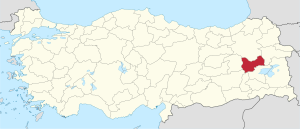
Muş ( Armenian Մուշ Musch , Kurdish Mûş ) is a province of Turkey and with 8,650 km² is one of the smaller provinces. The capital of the province is Mus and is located about 750 kilometers east of Ankara . At the Süphan Dağı (4058 m) it comes close to Lake Van for 20 km.
geography
37.9 percent of the province's area consists of plateaus, 34.9 percent of mountains and the remaining 27.2 percent of valleys. The valley of Muş extends between two chains of the eastern Taurus Mountains that run in a northeast-southwest direction . The city of Mus is at an altitude of 1404 m. The lowest altitude in the valley is 1300 m, the highest peak is the Bilican Tepe (also called Ziyaret or Vangesor) at 2950 m. Akdoğan Mountain, also called Hamurpet, in the north of the province reaches an altitude of 2879 m. The Bilica Mountains are located between Bulanık and Liz. The height of the mountains increases towards the south. Towards Bulanık the mountains get lower until they end abruptly. Other peaks are the Avni Kalesi Tepe with 2754 m, the Şeyhtokum with 2300 m, the Karaburun with 2500 m, the Hasan Tepe, the Akdoğan (Hamurpet), the Şerafettin, the Haçreş (Karaçavuş, Çavuş), the Otluk and the Yakupağa.
The Murat rises north of Lake Van on Mount Aladağ and the Karasu , which comes from the south, flows east-west through the south of the province. Both meet northwest of the provincial capital. Smaller rivers are the Heronek (24 km), the Liz (32 km) and the Memanlı (24 km).
The Great Hamurpetsee (Akdoğan Gölü) in the district of Varto lies at an altitude of 2149 m and has a depth of 21 m with an area of 1088 km². The lake is fed by springs and meltwater from the mountains. Cranes, carp, geese and beavers live by and in the lake. The small Hamurpetsee about 300 m south of the big one is 2173 m high and has an area of only 149 km². At 47 m it is deeper than the Great Hamurpetsee and flows into it underground.
location
The province is bordered by Erzurum Province to the north, Ağrı Province to the east , Bitlis and Batman provinces to the south, Diyarbakır Province to the southwest and Bingöl Province to the west .
Administrative division
The province is divided into six districts ( İlçe ):
| district | Area 1 (km²) |
Population (2018) 2 | Number of Units | Density (Ew / km²) |
urban share (in%) |
Sex ratio 3 |
Founding date 4.5 |
|||
|---|---|---|---|---|---|---|---|---|---|---|
| District ( İlçe ) | Administrative headquarters (Merkez) |
Municipalities (Belediye) |
City quarter (Mahalle) |
Villages (Köy) |
||||||
| Bulanık | 1,948 | 80,540 | 26,971 | 7th | 29 | 56 | 41.3 | 52.70 | 953 | |
| Haskoy | 264 | 25,749 | 12,238 | 2 | 12 | 17th | 97.5 | 53.70 | 973 | 1987 |
| Corkut | 775 | 25,817 | 3,614 | 2 | 7th | 30th | 33.3 | 24.46 | 955 | 1990 |
| Malazgirt | 1,595 | 51,323 | 19,880 | 2 | 16 | 74 | 32.2 | 42.05 | 956 | |
| Muş Merkez | 2,750 | 193.394 | 107,470 | 9 | 50 | 94 | 70.3 | 68.38 | 956 | |
| Varto | 1,318 | 31,169 | 9,921 | 1 | 7th | 93 | 23.6 | 31.83 | 972 | |
| PROVINCE of Mus | 8,650 | 407.992 | 23 | 121 | 364 | 47.2 | 55.47 | 957 | ||
swell
1 Area 2014
2 Population update on December 31, 2018
3 Gender ratio : number of women per 1000 men (calculated)
4 PDF file of the Ministry of the Interior
5 districts that were only formed after Turkey was founded (1923).
population
The majority of the population are Sunni Kurds . There are also Alevi Kurds, Turks and Circassians in Muş.
Results of the population extrapolation
The following table shows the annual population development after updating by the addressable population register (ADNKS) introduced in 2007. In addition, the population growth rate and sex ratio are ( Sex Ratio listed ie number of women per 1,000 men). The 2011 census determined 412,430 inhabitants, which is over 41,200 inhabitants less than in the 2000 census.
| year | Population at the end of the year | Population growth rate (in%) |
Gender ratio (women per 1000 men) |
Rank (among 81 provinces) |
||
|---|---|---|---|---|---|---|
| total | male | Female | ||||
| 2018 | 407.992 | 208,431 | 199,561 | 0.85 | 957 | 49 |
| 2017 | 404,544 | 205,658 | 198.886 | −0.48 | 967 | 48 |
| 2016 | 406.501 | 207.190 | 199.311 | −0.54 | 962 | 47 |
| 2015 | 408.728 | 208,329 | 200,399 | −0.61 | 962 | 47 |
| 2014 | 411.216 | 209,668 | 201,548 | −0.32 | 961 | 47 |
| 2013 | 412,553 | 210,513 | 202.040 | −0.17 | 960 | 47 |
| 2012 | 413.260 | 211,516 | 201,744 | −0.35 | 954 | 47 |
| 2011 | 414,706 | 212.717 | 201,989 | 1.92 | 950 | 46 |
| 2010 | 406.886 | 207.115 | 199,771 | 0.59 | 965 | 47 |
| 2009 | 404.484 | 207.251 | 197.233 | 0.04 | 952 | 47 |
| 2008 | 404.309 | 207.270 | 197.039 | -0.30 | 951 | 47 |
| 2007 | 405.509 | 206,589 | 198.920 | - | 963 | 47 |
| 2000 | 453.654 | 236.214 | 217,440 | 46 | ||
Census results
The following tables show the population of the province of Muş documented in the 14 censuses .
The values in the table on the left are taken from e-books (from the original documents), the values in the table on the right come from the data query of the Turkish statistical institute TÜIK - available on this website:
| year | population | rank | |
|---|---|---|---|
| province | Turkey | ||
| 1935 | 143,899 | 16.158.018 | 51 |
| 1940 | 73,939 | 17,820,950 | 60 |
| 1945 | 82,699 | 18,790,174 | 60 |
| 1950 | 107.286 | 20,947,188 | 59 |
| 1955 | 136.401 | 24,064,763 | 63 |
| 1960 | 167,638 | 27,754,820 | 62 |
| year | population | rank | |
|---|---|---|---|
| province | Turkey | ||
| 1965 | 198.716 | 31,391,421 | 59 |
| 1970 | 234,250 | 35.605.176 | 57 |
| 1975 | 267.203 | 40,347,719 | 56 |
| 1980 | 302.406 | 44,736,957 | 52 |
| 1985 | 339,492 | 50,664,458 | 52 |
| 1990 | 376,543 | 56.473.035 | 48 |
| 2000 | 453.654 | 67,803,927 | 46 |
Number of provinces in relation to the census years:
- 1927, 1940 to 1950: 63 provinces
- 1935: 57 provinces
- 1955: 67 provinces
- 1960 to 1985: 73 provinces
- 1990: 73 provinces
- 2000: 81 provinces
Municipalities (Belediye)
In addition to the provincial capital and the five district cities, there were 17 municipalities (Turkish: Belediye ) at the end of 2018 :
- Sungu (5,848 pop.)
- Erentepe (4,029)
- Yaygın (3,914)
- Konukbekler (3,348)
- Kızılağaç (2,883)
- Altınova (2,702)
- Armory (2,608 Pop.)
- Elmakaya (2,604)
- Serinova (2,516)
- Karaagacli (2,352)
- Uzgörür (2,111)
- Sarıpınar (2,107)
- Yoncalı (2,015 pop.)
- Yeşilova (1,983)
- Kırköy (1,920)
- Konakkuran (1,702)
- Düzkışla (1,588)
history
prehistory
The area of today's Muş province was obviously from the 6th millennium BC. Inhabited continuously until today. The oldest two sites date back to the Halaf culture . Since the Early Bronze Age, the settlements in the valley floor had been conveniently located on a trade route for obsidian and metal ores (silver, copper, lead) through the otherwise impassable mountains. Several sites are assigned to the South Caucasian Kura-Araxes culture according to the type of pot shards .
Antiquity and antiquity
The first written document that reports on Mus comes from the time of the Assyrian King Shalmaneser I (1274–1245 BC). It reports on a Nairi federation in eastern Anatolia. In the 13th century BC The Urartians , who presumably emerged from the Nairi Federation, settled in Muş. The centuries to come were ruled by the conflict between Urartu and Assyria .
Urartu is united into one empire in the 9th century under King Sarduri I. Under King Menua , Urartu is a powerful empire and encompasses all of Eastern Anatolia. A fortress near Kayalıdere in Varto County dates from the time of King Argišti I (764-735). Urartu disintegrated in 585 at the latest, after years of fighting Assyria and invading peoples such as the Cimmerians and Scythians . Muş was an important stop on the Urartus Royal Route. The route came from the east from the capital Tuspa (today's Van ) and then led through the valley of Malazgirt along the Murat to Varto. From here it continued west towards Elazığ and Malatya to Central Anatolia and Syria .
After the fall of Urartus, the Medes ruled the area. They appeared in the 7th century BC. In the valley of Mus. But less than a hundred years later the Median throne was taken over by the Achaemenid Cyrus II . The Persians ruled Mus for 200 years. Perhaps the Arodians settled in the area of Mus . Back then, Muş belonged to the satrapy of Babylon. The most important event from the Persian era was the passage of ten thousand Greek mercenaries under the command of Xenophon . He wrote in his anabasis that the people of Mus lived in tribes and helped their army with food and horses.
In the centuries to come, Mus was the scene of battles between the Romans and the Parthians . As a buffer between these powers were Armenian principalities, among them the canton of Taron (Mus) in the province of Turuberan. According to Armenian tradition, St. Gregory founded the first church of the Armenian Christians at the beginning of the 4th century in Ashtishat north of the city of Mus. Ashtishat was therefore the first religious center of the Armenians in early Christian times. The Surb Karapet Monastery was founded on the holy site of Ashtishat , an important pilgrimage center from the Middle Ages to the 19th century. Other monasteries in the area were Surb Arakelots and Yeghrduti Vank .
The Parthians were able to bind the principalities to themselves for a long time and keep the Romans away from Eastern Anatolia. The successors of the Parthians were the Sasanids , who opposed the Romans and later the Byzantines . The Sasanids ruled Mus for 400 years. But the Byzantine emperor Heraclios was able to defeat the Sasanids. But not long after that, in the 7th century AD, Muslim armies invaded Anatolia and Iran. The Sasanid Empire fell apart and the Arabs advanced to Mus, but could not drive the Byzantines from there. Johannes Mamikonean's "History of Taron" is an important early medieval source for the conflicts between the Byzantines and Sassanids in Muş in the 6th and 7th centuries.
middle Ages
Until 1071 Muş remained part of Byzantium with interruptions. It was part of the Taron theme . Taron remained the name of the province throughout the Middle Ages. In the year 641 the Arab general Iyad ibn Ghanm was able to take the important cities Bitlis , Ahlat and Mus . But the Arabs alternated here with the Byzantines. Under the Umayyads , Mus was administered from Diyarbakır . Under the Abbasids , Mus was later part of the al-ʿAwāsim region . With the decline of Abbasid control, Muş became part of the Bagratid Empire .
In the 11th century, invaded Seljuks in Iran and eastern Anatolia one. In 1054 they besieged Malazgirt. A little later the Seljuk ruler conquered Alp Arslan Malazgirt and prepared to subdue Syria. Emperor Diogenes recaptured the city. In 1071 the battle of Malazgirt finally took place , which Byzantium lost. With the battle, Byzantium lost Eastern Anatolia and the Turkish colonization began. Muş became part of the Seljuk Empire.
The Beylik of the Ahlatschahs originated in Ahlat in the 12th century . Muş also became part of this principality. In the period to come, Muş alternated between the Ahlachahs, the Ortoqids and the Ayyubids . In 1191 the Ayyubids besieged the castle of Malazgirt. But Mus remained part of the Ahlachahs, whose ruler was overthrown and killed by his son-in-law in 1196. The dead ruler's wife and son were detained in the fortress of Mus, but the occupier was driven out again in 1197.
In 1207 the principality of the Ahlachahs ended and the Ayyubids became the new rulers of Mus. Around 1225 Jalal ad-Din , the last ruler of Khorezm Shah invaded Mus and the surrounding area. He had fled from the Mongols and wanted to build a new empire in Anatolia. In doing so, he devastated entire areas. He was defeated in 1230 by the Rumeljuk Sultan Kai Kobad I and Muş became part of the Sultanate of Rum . But the Rumeljuks were subject to the Mongols in 1243. Muş was pillaged and devastated by the Mongols. Since the end of the Ahlachahs, Muş lost more and more of its cultural importance. There was a lot of construction activity among the Ahlachahs. The area became more and more Turkish . The successors of the Mongols were the Ilkhan .
In the coming centuries Muş part was the kingdom of the White Sheep and the kingdom of the black sheep . During the time of the Black Mutton rule, many Turkmens from Central Asia fled from Timur's armies. The rulers of Mus settled these refugees in the places Mus, Bulanık, Malazgirt and Varto. Eventually Timur invaded Anatolia and cities like Mus were looted and the people massacred. Centuries later, Evliya Çelebi wrote that the traces of the devastation could still be seen. The ruler of the black sheep, Qara Yusuf , sought refuge with the Ottomans in Western Anatolia. But these in turn were defeated near Ankara in 1402. A little later Timur withdrew from Anatolia. This enabled Qara Yusuf to return to his area. The competition of the black mutton was the white mutton. The most powerful ruler of the white mutton, Uzun Hasan , defeated the black mutton under Jahan Shah in 1467. In 1473, Uzun Hasan fought against the Ottomans for supremacy in Anatolia and lost. Uzun Hasan died in exile in 1478. Most of his empire fell to the Safavids . The Italian envoy Giosafat Barbaro visited Uzun Hasan at his court and said that Muş was well populated and the fortress was strong.
In 1514 there was a decisive battle between the Ottomans and the Safavids in Tschaldiran . The Ottomans won and Eastern Anatolia became an integral part of their empire. They bound the Kurdish princes in Eastern Anatolia by assuring them autonomy and were thus able to secure the border with Iran.
During the Ottoman period, Muş was once part of the Eyâlets of Van as a Sandschak and sometimes part of the Kurdish principality of Bitlis, whose most famous ruler was Scherefhan . When the principality ended, Mus became part of Erzurum. In the 18th century there was a local ruling dynasty in and around Mus.
Modern times
Due to its proximity to Iran, Muş and the surrounding area became the target of the war expeditions of the kings of Iran in 1794 and 1821. But the Ottomans were able to repel the attacks. With an edict of the high gate of 1839, all local rulers in the empire, including those of Muş, were to be eliminated and the empire more centralized. As a result, Muş lost his status and became part of Erzurum.
In 1899 the Hamidiye was founded in the east . These units, consisting of Kurdish tribal warriors , were mainly used against the danger from Russia, which threatened the Ottoman Empire in the east. But the Hamidiye also took sides in battles between the various Kurdish tribes. In 1890 the situation in the east escalated, with massacres between Armenians and the Muslim inhabitants. With the support of the Russians, the Armenians founded several committees, including the Dashnak . Their goal was to create an Armenian state in Eastern Anatolia. Mus was in the following decades scene more risings, such as the uprising 1895 of Sason .
First World War and the extermination of the Armenians
During World War I , Russian troops invaded the Ottoman Empire via the Caucasus through northeast Anatolia. At the same time, under the pretext of collaboration with the invaders, all Armenians who served in the Ottoman army were placed under arrest and the Armenian population rounded up in Muş either killed or deported. Kurdish tribes seized the Armenian owners and lands. Of the 140,000 Armenians in Sanjak Muş, 20,000 fled to the mountains. In 1915 the Russians advanced via Ağrı to Malazgirt. In February 1915 Varto and in 1916 Muş fell under Russian control. Many Muslim residents fled Muş from pressure from the Russians and the attacks by the Armenians. An Ottoman advance to retake Mus took place in August 1916. It was successful, but the Russians were able to conquer the city again. The Ottomans then recaptured the city on April 30, 1917. With the armistice of August 18, 1917, the Russians withdrew from the area.
After the defeat of the Ottomans in World War I, the Turkish War of Liberation began against the Allies and the Sultan. In the east, General Kâzım Karabekir fought against the Armenian troops, who continued to fight for their own state, but then had to withdraw from Anatolia. It was not until the Treaty of Alexandropol (Gümrü) on December 2, 1920 that the eastern border between Turkey and its neighbors was regulated and pacified.
Muş after 1923
In 1925, shortly after the establishment of the Republic of Turkey, the Sheikh Said uprising broke out in the east . This also expanded to Muş. The insurgents attacked the cities of Mus, Varto, Göynük and Malazgirt. Varto was captured, but the rebels were repulsed in front of Mus. A short time later, the uprising was put down and Sheikh Said was hanged.
Personalities
- Nilüfer Akbal , singer
- İsmet Elçi , writer and director
- Cibranlı Halit Bey , Kurdish officer in the Ottoman army
Web links
Individual evidence
- ↑ Türkiye Nüfusu İl ve İlçelere Göre Nüfus Bilgileri , accessed on July 9, 2019
- ^ Yavuz governor portrait on the website of the Mus Province
- ↑ Directorate General of Mapping İl ve İlçe Yüzölçümleri (PDF file 0.25 MB)
- ↑ Türkiye Nüfusu İl İlçe Mahalle Köy Nüfusu , accessed on July 9, 2019
- ↑ [1] TARİH (1) .pdf 1.4 MB
- ↑ Genel Nüfus Sayımları (census results 1965 to 2000)
- ↑ Mitchell S. Rothman, Gülriz Kozbe: Muş in the Early Bronze Age. In: Anatolian Studies 47, 1997, pp. 105–126, here p. 110.
- ^ Adrian Fortescue: The Lesser Eastern Churches. Catholic Truth Society, London 1913, p. 403 ( at Internet Archive )
- ↑ Nina G. Garsoïan: Taron as of early Christian Armenian center. In: Richard G. Hovannisian (Ed.): Armenian Bagesh / Bitlis and Taron / Mush. Mazda, Costa-Mesa (CA) 2001, p. 64.
- ↑ John Mamikonean's History of Taron . (PDF) Robert Bedrosian
- ^ Raymond Kévorkian : Le Génocide des Arméniens. Odile Jacob, Paris 2006, p. 297 f. and 421 ff.
Adana | Adıyaman | Afyonkarahisar | Ağrı | Aksaray | Amasya | Ankara | Antalya | Ardahan | Artvin | Aydın | Balıkesir | Bartın | Batman | Bayburt | Bilecik | Bing oil | Bitlis | Bolu | Burdur | Bursa | Çanakkale | Çankırı | Çorum | Denizli | Diyarbakır | Düzce | Edirne | Elazığ | Erzincan | Erzurum | Eskişehir | Gaziantep | Giresun | Gümüşhane | Hakkâri | Hatay | Iğdır | Isparta | İstanbul | İzmir | Kahramanmaraş | Karabük | Karaman | Kars | Kastamonu | Kayseri | Kırıkkale | Kırklareli | Kırşehir | Kilis | Kocaeli | Konya | Kutahya | Malatya | Manisa | Mardin | Mersin | Muğla | Muş | Nevşehir | Niğde | Ordu | Osmaniye | Rize | Sakarya | Samsun | Siirt | Sinop | Sivas | Şanlıurfa | Şırnak | Tekirdağ | Tokat | Trabzon | Tunceli | Usak | Van | Yalova | Yozgat | Zonguldak