
Kırklareli (Province)
| Kırklareli | |
|---|---|
| Province number: | 39 |
  |
|
| Counties | |
 |
|
| Basic data | |
| Coordinates: | 41 ° 41 ′ N , 27 ° 28 ′ E |
| Provincial capital: | Kırklareli |
| Region: | Marmara region |
| Surface: | 6,459 km² |
| Population: | 360,860 (2018) |
| Population density: | 56 inhabitants / km² |
| Political | |
| Governor: | Osman Bİlgİn |
| Seats in Parliament: | 3 |
| Structural | |
| Telephone code: | 0288 |
| Features : | 39 |
| Website | |
| www.kirklareli.gov.tr (Turkish) | |
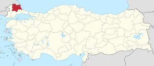
Kırklareli is a province in the European part of Turkey ( Eastern Thrace ), which extends on the Balkan Peninsula and thus belongs to the geographical and historical region of Thrace . The capital of the province is Kırklareli .
geography
The northwestern Turkish province borders in the south on the province of Tekirdağ , in the west on the province of Edirne . The northern border is the national border with Bulgaria , in the east the Black Sea coast forms the natural border.
The Yıldız Mountains ( Istranca , or Strandscha ) divides the Kırklareli Province into two sections.
The Black Sea coast of the Kırklareli province has beaches and many fish restaurants. 98 kilometers east of the capital Kırklareli, İğneada is nestled between sandy beaches and the Yıldız Mountains. Another resort is Kıyıköy .
Administrative division
The province is divided into eight districts ( İlçe ):
| district | Area 1 (km²) |
Population (2018) 2 | Number of Units | Density (Ew / km²) |
urban share (in%) |
Sex ratio 3 |
Founding date 4.5 |
|||
|---|---|---|---|---|---|---|---|---|---|---|
| District ( İlçe ) | Administrative headquarters (Merkez) |
Municipalities (Belediye) |
City quarter (Mahalle) |
Villages (Köy) |
||||||
| Babaeski | 670 | 48.391 | 29,569 | 4th | 21st | 31 | 72.2 | 75.90 | 934 | |
| Demirkoy | 893 | 9.093 | 3,400 | 2 | 5 | 15th | 10.2 | 67.02 | 825 | |
| Kofçaz | 545 | 2,368 | 644 | 1 | 2 | 16 | 4.3 | 27.20 | 921 | 1959 |
| Lüleburgaz | 1,016 | 148.037 | 117,739 | 4th | 33 | 31 | 145.7 | 88.17 | 978 | |
| Merkez Kırklareli | 1,623 | 102.909 | 79.093 | 4th | 25th | 40 | 63.4 | 85.37 | 934 | |
| Pehlivankoy | 104 | 3,565 | 1,597 | 1 | 3 | 8th | 34.3 | 44.80 | 982 | 1958 |
| Pinarhisar | 518 | 18,375 | 10,722 | 2 | 7th | 14th | 35.5 | 70.40 | 886 | 1953 |
| Vice | 1,090 | 28,122 | 13,986 | 3 | 12 | 24 | 25.8 | 64.66 | 960 | |
| Kırklareli PROVINCE | 6,459 | 360,860 | 21st | 108 | 179 | 55.9 | 81.63 | 949 | ||
swell
population
Results of the population extrapolation
The following table shows the annual population development at the end of the year after updating by the addressable population register (ADNKS) introduced in 2007. In addition, the population growth rate and the sex ratio (ie number of women per 1000 men) are listed. The 2011 census identified 340,977 inhabitants, over 12,500 more than in the 2000 census.
| year | Population at the end of the year | Population growth rate (in%) |
Gender ratio (women per 1000 men) |
Rank (among 81 provinces) |
||
|---|---|---|---|---|---|---|
| total | male | Female | ||||
| 2018 | 360,860 | 185.181 | 175,679 | 1.35 | 949 | 62 |
| 2017 | 356.050 | 181.945 | 174.105 | 1.24 | 957 | 62 |
| 2016 | 351,684 | 179.122 | 172,562 | 1.36 | 963 | 62 |
| 2015 | 346,973 | 177.352 | 169,621 | 0.95 | 956 | 63 |
| 2014 | 343.723 | 176.053 | 167,670 | 0.93 | 952 | 63 |
| 2013 | 340,559 | 173.916 | 166,643 | −0.19 | 958 | 62 |
| 2012 | 341.218 | 175,515 | 165.703 | 0.30 | 944 | 63 |
| 2011 | 340.199 | 175,678 | 164,521 | 2.23 | 936 | 62 |
| 2010 | 332.791 | 168,709 | 164.082 | −0.12 | 973 | 61 |
| 2009 | 333.179 | 170.136 | 163.043 | −1.12 | 958 | 61 |
| 2008 | 336,942 | 174.083 | 162,859 | 1.11 | 936 | 61 |
| 2007 | 333.256 | 171.204 | 162.052 | - | 947 | 60 |
| 2000 | 328,461 | 172.188 | 156.273 | 908 | 56 | |
Census results
The following tables show the population of Kırklareli Province documented in the 14 censuses .
The values in the table on the left are taken from e-books (from the original documents), the values in the table on the right come from the data query of the Turkish statistical institute TÜIK - available on this website:
| year | population | rank | |
|---|---|---|---|
| province | Turkey | ||
| 1927 | 108,989 | 13,648,270 | 53 |
| 1935 | 172.697 | 16.158.018 | 46 |
| 1940 | 256.353 | 17,820,950 | 35 |
| 1945 | 178.203 | 18,790,174 | 47 |
| 1950 | 191,376 | 20,947,188 | 48 |
| 1955 | 224,735 | 24,064,763 | 48 |
| 1960 | 241.146 | 27,754,820 | 52 |
| year | population | rank | |
|---|---|---|---|
| province | Turkey | ||
| 1965 | 258.386 | 31,391,421 | 54 |
| 1970 | 257.131 | 35.605.176 | 56 |
| 1975 | 268,399 | 40,347,719 | 54 |
| 1980 | 283,408 | 44,736,957 | 53 |
| 1985 | 297,098 | 50,664,458 | 55 |
| 1990 | 309,512 | 56.473.035 | 55 |
| 2000 | 328,461 | 67,803,927 | 56 |
Number of provinces in relation to the census years:
- 1927, 1940 to 1950: 63 provinces
- 1935: 57 provinces
- 1955: 67 provinces
- 1960 to 1985: 73 provinces
- 1990: 73 provinces
- 2000: 81 provinces
history
The region around Kırklareli was already settled in prehistoric times . The Archaeological Institute of the University of İstanbul has been excavating two prehistoric settlements together with the German Archaeological Institute since 1993 . The Neolithic Tell Aşağı Pınar dates to a period between 5900 and 5000 BC. BC, the Bronze Age settlement Kanlıgeçit, however, in the third millennium BC. Furthermore, various Iron Age burial mounds are known from the area . Numerous finds are exhibited in the small History Museum of the Kırklareli Province.
Throughout the Middle Ages, membership of the region was fought over between the Bulgarian and Byzantine empires . In 896 the Bulgarian Tsar Simeon I defeated the Byzantines in the battle of Bulgarophygon (today Babaeski).
In 1903 the Ilinden-Preobraschenie Uprising , organized and carried out by the Bulgarian Macedonia-Adrianople Revolutionary Committee , took place. The aim of the uprising was to liberate as many Bulgarian areas as possible and to unite them with the Principality of Bulgaria at a later date, with the will of the great powers . The insurgents were poorly armed and outnumbered: the Turkish government sent an army of 350,000 soldiers with artillery and cavalry to meet the 26,000 insurgents . More than 70,000 Thracian Bulgarians fled to neighboring countries, especially Bulgaria. Burgas became the largest refugee city .
Many Bulgarians lived here until the Second Balkan War (1913) and Greeks who were expelled until the beginning of the 20th and 20th centuries (see also Teşkilât-ı Mahsusa ).
Kırklareli ("Land of the Forties") was called Kırkkilise, "Forty Churches" until 1924.
Attractions
The Sokollu Mosque in Lüleburgaz on the route between Edirne and İstanbul is the work of Mimar Sinan and was built in 1570. Also from Sinan is the Ali-Paşa Mosque in the neighboring town of Babaeski .
The Hızır Bey Mosque, the oldest in the provincial capital Kırklareli, was built in 1388. Under Hızır Bey , a bathhouse was built next to the mosque. The Kirklar monument from the 14th century, consisting of 18 columns, stands on the same hill in memory of 40 Janissaries who during the conquest of the territory by Sultan Murat I. fell.
Web links
- Website of the Turkish Ministry of Culture about the Kırklareli Museum
- Kırklareli Province Historical-Ethnographic Museum
- Data on Kırklareli
- Population figures across all districts, malls and villages (2007-2018)
Individual evidence
- ↑ Türkiye Nüfusu İl ve İlçelere Göre Nüfus Bilgileri , accessed on July 4, 2019
- ↑ Governor's portrait on the Kırklareli Province website , accessed July 4, 2019
- ↑ Directorate General of Mapping İl ve İlçe Yüzölçümleri (PDF; 0.25 MB).
- ↑ Türkiye Nüfusu İl İlçe Mahalle Köy Nüfusu , accessed on July 4, 2019.
- ↑ illeridaresi.gov.tr (PDF; 1.4 MB).
- ↑ Türkiye Nüfusu İl ve İlçelere Göre Nüfus Bilgileri , annual population update 2007-2018, accessed on July 4, 2019
- ↑ Genel Nüfus Sayımları (census results 1965 to 2000).
- ↑ Lyubomir Miletich : Разорението на тракийскитеѣ българи презъ 1913 година (. Bulg Razorjawaneto na trakijskite Balgari prez 1913 godina) Publisher Balgarski bestseller, Sofia, 2003, p 303, ISBN 954-9308-14-6
Adana | Adıyaman | Afyonkarahisar | Ağrı | Aksaray | Amasya | Ankara | Antalya | Ardahan | Artvin | Aydın | Balıkesir | Bartın | Batman | Bayburt | Bilecik | Bing oil | Bitlis | Bolu | Burdur | Bursa | Çanakkale | Çankırı | Çorum | Denizli | Diyarbakır | Düzce | Edirne | Elazığ | Erzincan | Erzurum | Eskişehir | Gaziantep | Giresun | Gümüşhane | Hakkâri | Hatay | Iğdır | Isparta | İstanbul | İzmir | Kahramanmaraş | Karabük | Karaman | Kars | Kastamonu | Kayseri | Kırıkkale | Kırklareli | Kırşehir | Kilis | Kocaeli | Konya | Kutahya | Malatya | Manisa | Mardin | Mersin | Muğla | Muş | Nevşehir | Niğde | Ordu | Osmaniye | Rize | Sakarya | Samsun | Siirt | Sinop | Sivas | Şanlıurfa | Şırnak | Tekirdağ | Tokat | Trabzon | Tunceli | Usak | Van | Yalova | Yozgat | Zonguldak