Yeşilhisar (Kayseri)
| Yeşilhisar | ||||
|
||||
| Basic data | ||||
|---|---|---|---|---|
| Province (il) : | Kayseri | |||
| Coordinates : | 38 ° 21 ' N , 35 ° 5' E | |||
| Height : | 1143 m | |||
| Surface: | 1,008 km² | |||
| Residents : | 16,218 (2013) | |||
| Population density : | 16 inhabitants per km² | |||
| Telephone code : | (+90) 352 | |||
| Postal code : | 38800 | |||
| License plate : | 38 | |||
| Structure and administration (status: 2014) | ||||
| Mayor : | Abdulkadir Akdeniz ( AKP ) | |||
| Website: | ||||
| Yeşilhisar County | ||||
| Residents : | 16,218 (2013) | |||
| Surface: | 1,008 km² | |||
| Population density : | 16 inhabitants per km² | |||
| Kaymakam : | Mehmet Şirin Yaşar | |||
| Website (Kaymakam): | ||||
Yeşilhisar is a city and a district in the Kayseri province of Turkey . Since a regional reform in 2014, the municipality ( Belediye ) is congruent with the district (İlçe). All previous villages ( Köy ) are now districts ( Mahalle ) of the municipality. The city is located about 55 kilometers southwest of the provincial capital Kayseri . The previous name was Develikarahisarı. In ancient times the city was called Kyzistra [Κύζιστρα].
The district is located in the west of the province. It borders in the northeast with İncesu , in the east with Develi , in the southeast with Yahyalı , in the southwest with the province Niğde and in the northwest with the province Nevşehir . The D805 trunk road from Kayseri to Ulukışla runs through the city and the district in a north-south direction . Other road connections lead from Yeşilhisar in the west to Ürgüp and Derinkuyu and in the southeast to Yahyalı. The railway line runs roughly parallel to the D805 from Kayseri via Niğde to Ulukışla, which has a stop in the district town. In the west of the district lies part of the Hodul Dağı mountain range , the flat east belongs to the Develi Plain ( Develi Ovası ). There are the mostly dried up lakes Sobe Gölü and Yay Gölü . The district includes two reservoirs, the Kovalı Barajı in the very south and the Akköy Barajı about seven kilometers west of Yeşilhisar.
Worth seeing
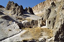
About ten kilometers west of the district town is the Soğanlı valley with numerous rock churches in the Cappadocian tuff landscape . To the east is the Sultansazlığı National Park with a swampy landscape that is well worth seeing and is home to numerous species of birds.
Personalities
- Umut Bulut (* 1983), Turkish soccer player
Web links
Individual evidence
- ↑ a b Turkish Institute for Statistics ( Memento from July 14, 2014 in the Internet Archive ), accessed June 15, 2014
- ↑ Sevan Nişanyan: Adini unutan Ülke. Türkiye'de Adı Değiştirilen Yerler Sözlüğü. Istanbul 2010, p. 198


