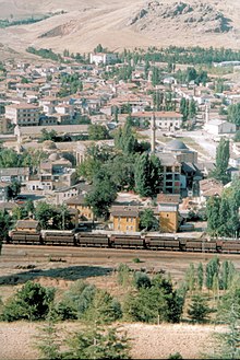
Ulukışla
| Ulukışla | ||||
|
||||
| Basic data | ||||
|---|---|---|---|---|
| Province (il) : | Niğde | |||
| Coordinates : | 37 ° 33 ' N , 34 ° 29' E | |||
| Height : | 1430 m | |||
| Residents : | 7,395 (2018) | |||
| Telephone code : | (+90) 388 | |||
| Postal code : | 51 900 | |||
| License plate : | 51 | |||
| Structure and administration (as of 2019) | ||||
| Structure : | 8 mahall | |||
| Mayor : | Ali Uğurlu ( AKP ) | |||
| Postal address : | Doğu Mahallesi İnönü Caddesi No: 67 51900 Ulukışla / NİĞDE |
|||
| Website: | ||||
| Ulukışla County | ||||
| Residents : | 23,252 (2018) | |||
| Surface: | 1,375 km² | |||
| Population density : | 17 inhabitants per km² | |||
| Kaymakam : | Arif Oltulu | |||
| Website (Kaymakam): | ||||
Ulukışla is a city and capital of the district of the same name ( İlçe ) in the central Anatolian province of Niğde . The city is located about 50 kilometers south of the provincial capital Niğde near the junction of the roads D805 from Niğde and the E 90 from Ankara to Tarsus .
The district is located in the south of the province and borders on Çamardı County in the northeast , Bor County in the north , Konya Province in the west , Mersin Province in the south and Adana Province in the southeast . Ulukışla is on the north side of the Bolkar Dağları, to the west of the city is the Ulukışla Geçidi pass , which leads into the Ereğli Plain (Ereğli Ovası) .
In addition to the district town (32% of the district's population), the district consists of 38 villages ( Köy ) with an average of 417 residents. The range of the population goes from 1664 down to 13, whereby the smallest municipality of the province lies in this district ( Tabaklı ). Darboğaz (1,664), Kılan (1,613), Hasangazi (1,016) and Çiftehan (984 inhabitants) are the largest villages in the district.
Worth seeing
About ten kilometers east of Ulukışla is the settlement hill Porsuk Hüyük (also Zeyve Höyük), which was inhabited from the Hittite to the Byzantine period. About ten kilometers southeast of it, on a rock face of the Bolkar Dağları Mountains , the late Hittite rock inscription is carved by Bulgarian soldiers . The ruins of the ancient Faustinopolis are located about 25 kilometers northeast of the city near today's Başmakçı .
Web links
Individual evidence
- ↑ a b Türkiye Nüfusu İl ilçe Mahalle Köy Nüfusları , accessed on July 14, 2019


