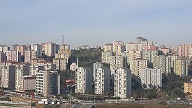
Kağıthane
| Kâğıthane | |||
|
|||
 A view of the Kağıthane district |
|||
| Basic data | |||
|---|---|---|---|
| Province (il) : | Istanbul | ||
| Coordinates : | 41 ° 4 ' N , 28 ° 58' E | ||
| Telephone code : |
(+90) 212 (European part) (+90) 216 (Asian part) |
||
| Postal code : | 34 xxx | ||
| License plate : | 34 | ||
| Structure and administration (status: 2009) | |||
| Mayor : | Fazlı Kılıç ( AKP ) | ||
| Website: | |||
| Kâğıthane County | |||
| Residents : | 432,230 (2014) | ||
| Surface: | 14.83 km² | ||
| Population density : | 29,146 inhabitants per km² | ||
| Kaymakam : | Ahmet Narinoğlu | ||
| Website (Kaymakam): | |||
Kâğıthane ( Greek Γλυκά Νερά Glykà Nerà ) is the capital of the district of the same name in the Turkish province of İstanbul and a district on the European side of İstanbul . According to the last census, Kağıthane had 432,230 inhabitants (as of 2014).
history
In the 17th century, Kâğıthane was a favorite destination for excursions and hunting for the Sultan, presumably because it could be easily reached by boat across the Golden Horn . The stream of the same name was a parade route for the typical local boats (Turkish kayık ). During the era of tulip time , which lasted from 1718 to 1730, Kağıthane was a popular place of İstanbul. During this time around 100 buildings / villas (in Turkish: Köşk ) were built, from which the name kiosk is derived. The previously warlike empire devoted itself to growing tulips .
This era, which was also characterized by luxury and ostentation, ended with the Patrona Halil uprising , which bears the name of its author, Patrona Halil. During this uprising, the magnificent mansions in Kâğıthane were largely destroyed. Shortly thereafter, the tulip growers emigrated to Holland . In the 20th century, industrialization brought about the end of the rural area and rapid urbanization . Around 1900 the first factories were reached in the strategically located region, including flour mills and a paper mill, from which the district takes its name (Turkish Kâğit hane "paper house"). There was practically no residential development until the middle of the 20th century. Settlement began in the 1950s with migrant workers from Anatolia who worked in the factories, on construction sites and in the service sector and built temporary housing here, the so-called gecekondus . Over time this was legalized and later replaced by rental apartments. The working-class district became one of the centers of the booming Istanbul real estate market, as numerous business buildings and apartments for the middle class were built in Kâğıthane . Until 1954 Kagithane belonged to Beyoğlu , from 1954 to 1987 to Şişli .
Population development
| Population development Kağıthane | |||||||||||||||
|---|---|---|---|---|---|---|---|---|---|---|---|---|---|---|---|
| year | 1950 | 1955 | 1960 | 1965 | 1970 | 1975 | 1980 | 1985 | 1990 | 1997 | 2000 | 2007 | 2014 | ||
| Residents | 1,431 | 3,084 | 22,818 | 56,157 | 111,427 | 164,448 | 175,540 | 220.996 | 269,042 | 317,238 | 345.239 | 418.229 | 432.230 | ||
Web links
Individual evidence
- ^ Turkish Institute for Statistics, 2014 ( Memento February 10, 2015 on WebCite ), accessed May 2, 2015


