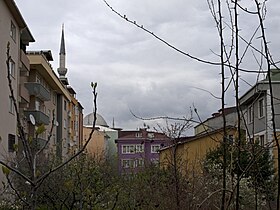
Umraniye
| Umraniye | |||
|
|||

|
|||
| Basic data | |||
|---|---|---|---|
| Province (il) : | Istanbul | ||
| Coordinates : | 41 ° 8 ' N , 29 ° 9' E | ||
| Height : | 75 m | ||
| Telephone code : |
(+90) 212 (European part) (+90) 216 (Asian part) |
||
| Postal code : | 34 xxx | ||
| License plate : | 34 | ||
| Structure and administration (status: 2009) | |||
| Mayor : | Hasan Can ( AKP ) | ||
| Website: | |||
| Ümraniye County | |||
| Residents : | 674,131 (2014) | ||
| Surface: | 45.30 km² | ||
| Population density : | 14,881 inhabitants per km² | ||
| Kaymakam : | Mehmet Ali Yıldırım | ||
| Website (Kaymakam): | |||
Ümraniye is the capital of the district of the same name in the Turkish province of İstanbul and a district on the Asian side of İstanbul . Ümraniye has 674,131 inhabitants (as of 2014).
Population development
| Population development Ümraniye | |||||||||||||||
|---|---|---|---|---|---|---|---|---|---|---|---|---|---|---|---|
| year | 1950 | 1955 | 1960 | 1965 | 1970 | 1975 | 1980 | 1985 | 1990 | 1997 | 2000 | 2007 | 2014 | ||
| Residents | 885 | 1,781 | 7,224 | 14,800 | 22,969 | 38,730 | 71,954 | 131,495 | 242.091 | 498,952 | 605.855 | 897.260 | 674.131 | ||
Sports
The most famous sports club in the district is the Ümraniyespor football club . He played with several small interruptions for 14 years in the TFF 1st Lig , the second highest Turkish league, and in the TFF 2nd Lig , the third highest Turkish league.
In the second division season 2016/17 , the club was the only Istanbul representative in the TFF 1. Lig and thus after the Istanbul first division clubs Beşiktaş Istanbul , Fenerbahçe Istanbul , Galatasaray Istanbul , Istanbul Başakşehir and Kasımpaşa Istanbul, the Istanbul club with the sixth highest placement in Turkish professional football.
Web links
Individual evidence
- ^ Turkish Institute for Statistics, 2014 ( Memento of February 10, 2015 on WebCite ), accessed May 9, 2015


