
Torstein Castle
| Torstein Castle | ||
|---|---|---|
 The rock gate |
||
| Creation time : | (I.) early (II.) 13th century | |
| Castle type : | Höhenburg, spur location | |
| Conservation status: | Rampart | |
| Place: | Bad Tabarz | |
| Geographical location | 50 ° 51 '17.7 " N , 10 ° 29' 48.4" E | |
| Height: | 566 m above sea level NN | |
|
||

The remains of Wallburg Torstein in older spelling Thorstein called, is an Outbound Spur castle on a mountain ridge in Bad Tabarz in the district of Gotha in the Thuringian Forest .
location
The castle site of the Spornburg rises to a small 566 m above sea level. NN high rock spur of the Kleiner Wagenberg , about 80 m above the Lauchagrund . It is located about 3 km southwest of Tabarz. Immediately by the castle, a medieval trade route, today's L 1024, leads past the Grenzwiese - Kleiner Inselsberg . The castles Stolzenburg and Leuchtenburg were only about 1 km away on this road .
description
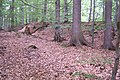
The castle complex extends on a north-east oriented mountain spur of the Kleiner Wagenberg . The approximate size of the entire facility is 250 × 80 m. At the Dürre Wiese refuge , the access path leads into the castle complex . First of all, an approximately 80 m long earth wall across the mountain spur is to be noticed, it is located just north of the refuge and seals off the actual castle site. After about 150 m you reach the main wall of the castle. This is still clearly recognizable with an upstream ditch in an arched course over the northern edge of the mountain spur. The interior of the castle is overgrown today and is only cut through on the southeast side by a hiking trail that leads through the peat rock. This rock marks the eastern edge, followed by a steep drop. The western edge is also protected by a steep drop. The northern edge of the castle complex has a pre-plateau, which is bordered by further rocky areas. This barely 50 × 30 m area could have served as a prehistoric mountain sanctuary. It was protected by the castle complex and the precipices. Today a serpentine-like footpath leads down to the rocks in the Lauchagrund.
history
In forestry work in the field a hammer stone was found that the plant as Urnfield Wallburg should occupy.
The numerous ravines on the south-eastern slope point to a second phase of use as a high medieval fortress. This can be seen as a supplementary fortification of the Leuchtenburg, which is only about 1 km away.
The Tabarz local history researcher Carl Lerp was able to find out more background information through archive work around 1880: he reports that an initially only weakly pronounced gap in the rock was expanded like a cave by blasting on the instructions of the Gotha Duke Ernst . This was intended to set an additional attractive accent at a popular resting place and hunting camp of the Gotha Duke.
Name interpretation
The name Thorstein refers to the rock formation of the Thorstein - a huge natural porphyry gate at the northern end of the Kleiner Wagenberg.
status
The castle site is a protected ground monument and nature reserve. The area in question is used for forestry to a limited extent.

Outer wall
Inner wall

On the inner wall

The area framed by rocks - a sanctuary?


literature
- Hermann Nebe: "Leuchtenburg and Torstein" . In: Thuringian castle trips . Third episode. Philipp Kühner, Eisenach 1925, p. 67-73 .
- Michael Köhler: «Thorstein» - Thuringian castles and fortified prehistoric and early historical living spaces . Jenzig-Verlag, Jena 2001, ISBN 3-910141-43-9 , p. 247 .
- Carl Lerp: The summer resort Tabarz (Grosstabarz and Kleintabarz) and the immediate vicinity. A guide for spa guests and tourists . Friedrichroda 1889, p. 41 .
See also
Web links
Individual evidence
- ↑ Official topographic maps of Thuringia 1: 10,000. Wartburgkreis, district of Gotha, district-free city of Eisenach . In: Thuringian Land Survey Office (Hrsg.): CD-ROM series Top10 . CD 2. Erfurt 1999.
- ^ Luise Gerbing : The field names of the Duchy of Gotha and the forest names of the Thuringian Forest between the Weinstrasse in the west and the Schorte (sluice) in the east; on behalf of the Association for Thuringian History and Archeology. and ed. by Luise Gerbing . S. 428. Jena G. Fischer, 1910 ( archive.org [accessed on May 23, 2020]).