
Burgstall Kammermaier
| Burgstall Kammermaier | ||
|---|---|---|
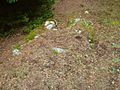
 Burgstall Kammermaier: mountain plateau |
||
| Alternative name (s): | Kammerhof | |
| Creation time : | unknown | |
| Castle type : | Höhenburg, spur location | |
| Conservation status: | Burgstall, remains of the wall | |
| Place: | Trölsberg, municipality of Neumarkt in the Mühlkreis | |
| Geographical location | 48 ° 28 '39.4 " N , 14 ° 27' 46.8" E | |
| Height: | 720 m above sea level A. | |
|
||

The Burgstall Kammermaier , also called Kammerhof , refers to an abandoned spur castle at 720 m above sea level. A. in the Trölsberg district of the Neumarkt im Mühlkreis district in the Freistadt district .
history
The name of the original castle has not been preserved. There is also no documentary evidence of the castle. It is believed that this was the seat of the chamberlain . It was probably destroyed in an invasion from Bohemia, similar to Kronest Castle . As early as 1499 it was known as the “Purckstal”.
In 1544 the name Kammermeier appears, in 1591 it belonged to Gilly Kammermeier, in 1629 Matheuss Khambermaier. The castle belonged to the vineyard lordship .
The castle lay on the spur of the Kammermaierberg. To the north it was protected by a moat. There are clear remains of walls and ditches . The foundation walls of a tower can probably be seen . Without closer examination, it is not possible to determine exactly which formations are artificially constructed or which are of natural origin. However, a distinction can be made in the area between a castle core and the fore area; the size of the castle must have been considerable.
The Postal can not miss when you ascend from the house Trölsberg 20, former Meierhof, about 500 meters towards the chamber Maier mountain.
photos
Burgstall Kammermaier: tower foundation

Burgstall Kammermaier: masonry

Burgstall Kammermaier: outer wall (?)

Burgstall Kammermaier: Archway


literature
- Oskar Hille: Castles and palaces in Upper Austria then and now . Verlag Ferdinand Berger & Sons, Horn 1975, ISBN 3-85028-023-3 .
- Norbert Grabherr : Castles and palaces in Upper Austria. A guide for castle hikers and friends of home . 3. Edition. Oberösterreichischer Landesverlag, Linz 1976, ISBN 3-85214-157-5 .
- Christian K. Steingruber : A critical consideration of the historical-topographical manual by Norbert Grabherr . Upper Austrian Provincial Archives , Linz.