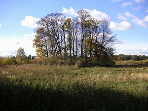
Gädebehn castle wall
| Gädebehn castle wall | |
|---|---|
|
View of the former island castle |
|
| Alternative name (s): | Seewerder |
| Creation time : | 10th to 12th centuries |
| Castle type : | Niederungsburg |
| Conservation status: | Ground tracks |
| Place: | Knorrendorf -Gädebehn |
| Geographical location | 53 ° 36 '47 " N , 13 ° 5' 15" E |
The rampart of Gädebehn , a district of the municipality of Knorrendorf in the Mecklenburg Lake District, is located about 600 meters south of the former manor house in the silting area of the Gädebehner See . The Slavic rampart as an original island castle in the heavily silted up lowland area on the east bank of the lake has a diameter of only fifty meters, is a maximum of 1.50 meters high and has an embankment on all sides. The castle is popularly known as the “Seewall” or “Werder”. The castle is one of the smallest Slavic fortifications in the area. Ceramic shards have already been recovered here. They date from the Yugoslav period from the 11th to the 12th centuries. A local Slavic nobleman may have lived here. The castle could accommodate a maximum of five to ten wooden structures (houses, fountains, etc.). Earth walls are no longer visible. The castle was probably only secured with palisades. As there are several Slavic castles on the Gädebehner, Möllner and Kastorfer lakes, which used to be a large lake, this must have been an important area in the past. One suspects the tribal center of the Slavic Tollensians here .
literature
- Uwe Schwarz: The fortifications of the 13th to 16th centuries in the Neubrandenburg district. Berlin 1987
