Bylot Island
| Bylot Island | |
|---|---|
| Bylot Island satellite image | |
| Waters | Arctic Ocean |
| Geographical location | 73 ° 15 ′ N , 78 ° 50 ′ W |
| length | 182 km |
| width | 110 km |
| surface | 11,067 km² |
| Highest elevation | Angilaaq Mountain 1951 m |
| Residents | uninhabited |
| Byam Martin Mountains on Bylot Island | |
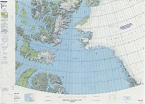
The Bylot Island , part of the Sirmilik National Park , is located directly opposite the northern end of Baffin Island in the Canadian territory of Nunavut and from there to the south by the Pond Inlet, to the southwest by the Eclipse Sound and to the west by the Navy Board Inlet separated. On its northeast side, the ocean currents of Baffin Bay and Lancastersund meet. With an area of 11,067 km², it is the seventeenth largest island in Canada and the seventy-one largest island in the world .
The mountainous central massif of the island, which forms part of the Arctic Cordillera , rises to almost 2000 meters and is about half covered with an ice cap. From it over 500 mostly unnamed glacier tongues flow partly to the sea, partly to the lowlands of the island, the Lowlands . From southeast to northwest, the island is crossed by the mountain range of the Byam Martin Mountains, the highest mountain peak of which is the centrally located, 1951 meter high Angilaaq Mountain. The coasts of the island are predominantly characterized by steep, palisade-like rising cliffs and glaciers migrating towards the sea. Flatter stretches of coastline with many glacier streams are located on the northeast coast, on the northwest tip and in the southwestern coastal region known for hoodoos .
Bylot Island is a bird's paradise because of the cliffs towering up at Cape Hay in the northwest on Lancaster Sound and around Cape Graham Moore in the southeast at the transition from the Pond estuary to Baffin Bay . More than 50 species of birds have been observed here, including around 320,000 beak- billed lemurs , 50,000 kittiwakes and 100,000 great snow geese . For their protection, the Bylot Island Migratory Bird Sanctuary was established in 1965 .
The island was settled more than 4000 years ago by members of the Dorset and Thule cultures , as well as by their successors, the Inuit . In the 17th century William Baffin and Robert Bylot , after whom the island is named, advanced to Lancastersund. The first landing took place in 1818 under John Ross , who raised the British flag in Possession Bay and took possession of the land for Great Britain. It was not until 1872 that it was recognized that Possession Bay was not part of Baffin Island. In 1906 the Bylot Island was declared part of the Canadian national territory by Captain Joseph Elzéar Bernier. After 1910, Button Point near Cape Graham Moore was a trading post for a few years, the relics of which can still be seen. The island is no longer permanently inhabited today.
Web links
- Parks Canada website (English)
- Explore North Website "Bylot Island" (English)
Individual evidence
- ↑ Statistics Canada: Area of major sea islands, by region
- ↑ Yukon, Northwest Territories and Nunavut Ultra-Prominences
- ↑ Angilaaq Mountain on Peakbagger.com (English)
- ↑ Olivier Gilg: Bylot Island . In: Mark Nuttall (Ed.): Encyclopedia of the Arctic . tape 1 . Routledge, New York and London 2003, ISBN 1-57958-436-5 , pp. 294–295 ( limited preview in Google Book search).


