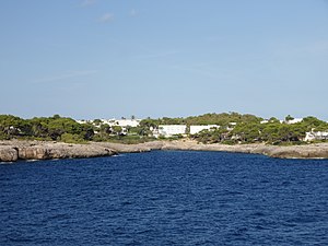
Caló des Llamp
| Caló des Llamp | ||
|---|---|---|
|
Caló des Llamp |
||
| Waters | Mediterranean Sea | |
| Land mass | Mallorca | |
| Geographical location | 39 ° 21 '32.3 " N , 3 ° 13' 14.2" E | |
|
|
||
| width | 25 m | |
| Greatest water depth | 10 m | |
The Caló des Llamp is a bay in the east of the Balearic island of Mallorca . The Caló des Llamp belongs to the area of the municipality of Santanyí .
Location and description
The rocky Caló des Llamp is located in the village of Cala d'Or in the district of Cala Egos in the eastern outer area of the Cala de sa Torre (Cala de Portopetro) and overlooks the headland of the Punta de sa Torre with the Torre Portopetro (tower) and the Far de Portopetro (beacon).
The bay has a width of about 25 meters and a length of about 90 meters.
There are mainly private houses around the bay .
hotel
- Casa Blanca
Web links
Commons : Caló des Llamp - Collection of images, videos and audio files

