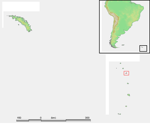
Candlemas Islands
| Candlemas Islands | |
|---|---|
| NASA image of the Candlemas Islands | |
| Waters | South Atlantic |
| archipelago | South Sandwich Islands |
| Geographical location | 57 ° 5 ′ S , 26 ° 39 ′ W |
| Number of islands | 2 (without secondary islands ) |
| Main island | Candlemas Island |
| Total land area | 17 km² |
| Residents | uninhabited |
The Candlemas Islands (English Candlemas Islands , also light measuring islands ) are a group of islands under British administration in the southern Atlantic Ocean . The group in the north of the South Sandwich Islands consists of the two uninhabited islands Candlemas Island and Vindication Island as well as a number of tiny rocky islands .
In part, the two islands are geographically assigned to the Traversay Islands , a group of islands 50 km further north-west. The Candlemas Islands were discovered by James Cook on the day of light measurement (February 2) in 1775 , but the three Traversay Islands were discovered around 45 years later by Fabian Gottlieb von Bellingshausen .
Web links
- Candlemas Island in the Global Volcanism Program of the Smithsonian Institution (English).
- Candlemas Island, South Sandwich Islands. Brief description with a focus on volcanology. In: Volcano World . Oregon State University (English).
Individual evidence
-
↑
- Johann Reinhold Forster 's [...] trip around the world between 1772 and 1775 in the ship the Resolution [...] led by Captain Cook . Described and edited by his son and travel companion George Forster . Second volume. Berlin by Haude and Spener. 1780. pp. 419 f. deutschestextarchiv
- Forster, Therese: Georg Forster's all writings. Johann Reinhold Forster's and Georg Forster's journey around the world in the years 1772 to 1775. Volume 2. Leipzig 1843. P. 410 books.google
- Johann Reinhold Forster's [...] remarks [...] collected on his trip around the world. Translated and with additional notes by his son and travel companion Georg Forster. Berlin Haude and Spener 1783, p. 19 books.google ; Transcription at projekt-gutenberg.org

