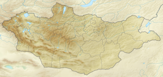
Chan-Chuchin-Ula
| Chan-Chuchin-Ula | ||
|---|---|---|
| Highest peak | Chan Chuchin Orgil ( 2928 m ) | |
| location | Uws-Aimag in Mongolia ( Russia ) | |
|
|
||
| Coordinates | 49 ° 38 ' N , 93 ° 24' E | |
The Chan-Chuchin-Ula ( Mongolian Хан Хөхийн нуруу ; Russian Хан-Хухийн-Ула, Хан-Хухэй Chan-Chuchei ) is a mountain range in the Uws-Aimag in northwestern Mongolia .
The mountain range runs in a west-east direction over a length of about 250 km. It separates the Uws-Nuur Basin to the north from the Chjargas-Nuur Basin to the south . The highest point is the Chan-Chuchin-Orgil with 2928 m . The northern part of the mountain range consists mainly of Precambrian crystalline rock and granite from the lower Paleozoic . In the southern part, effusive and sedimentary rocks dominate . The mountains have mostly flat peaks and steep slopes. The mountain ridges are partly glaciated . Steppe vegetation , larch and Siberian stone pine forests as well as grassy areas can be found on the northern slopes . In the south, desert and semi-desert-like vegetation dominates.
Mountains (selection)
Below are a number of peaks along the main ridge of the Chan-Chuchin-Ula mountain range, sorted from west to east:
![]() Map with all coordinates: OSM | WikiMap
Map with all coordinates: OSM | WikiMap
- Chan Chuchin Orgil ( 2928 m ) ( ⊙ )
Web links
Individual evidence
- ↑ a b c d e f Article Chan-Chuchin-Ula in the Great Soviet Encyclopedia (BSE) , 3rd edition 1969–1978 (Russian)

