Batch
| Batch | ||
|---|---|---|
| Charg (1973) | ||
| Waters | Persian Gulf | |
| Geographical location | 29 ° 15 ′ 0 ″ N , 50 ° 19 ′ 0 ″ E | |
|
|
||
| length | 8 kilometers | |
| width | 4.5 km | |
| surface | 22.59 km² | |
| Highest elevation | Kūh-e Dīdeh Bānī 70 m |
|
| Residents | 10,000 443 inhabitants / km² |
|
| main place | Batch | |
| Kharg satellite image, 1993 | ||
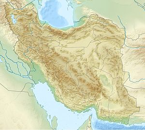
Charg ( English Kharg ; Persian خارگ, DMG Ḫārg , tooخارک, DMG Ḫārk ) is an inhabited island in the Persian Gulf . It belongs to Iran , is about 30 kilometers off the coast of the mainland and is about 6 km long and 4 km wide, the population is about 10,000. The island is 55 km west of Bushehr and 35 km south of Ganaveh .
history
The island was first settled by Nestorians . In 1756 the island was occupied by the Netherlands with two ships and 50 soldiers.
economy
The island is close to several oil fields and is of strategic importance. It has an oil terminal and an airfield . Tankers can dock at the oil terminal from four sides. In the 1970s, Charg was considered the most modern oil terminal in the world. The island had a fresh water extraction system and an agriculturally used greenhouse to supply the inhabitants of Charg.
During the First Gulf War , the facilities were badly damaged by Iraqi air strikes , but have since been repaired.
In 2012, 98% of Iran's crude oil exports went through the Kharg oil terminal . In order to reduce this dependence on a single oil export port, there have been plans since at least 2008 to build a second large oil port in Bandar-e Jask at the exit of the Strait of Hormuz .
Web links
- Charg . In: Ehsan Yarshater (Ed.): Encyclopædia Iranica (English, including references)
Footnotes
- ↑ Iran increases oil storage capacity to foil EU sanctions . Presstv.com. Retrieved November 28, 2012.
- ↑ Iran to build new oil export terminals in Persian Gulf
- ↑ Iran plans to turn Jask port into its 2nd oil hub


