Cheney Bluff
| Cheney Bluff | ||
|---|---|---|
| location | Ross Dependency , Antarctica | |
| part of | Transantarctic Mountains | |
|
|
||
| Coordinates | 79 ° 39 ′ S , 159 ° 48 ′ E | |
|
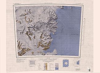
Topographic map (1: 250,000) with Cheney Bluff (center) |
||
The Cheney Bluff is a steep rock cliff at the Hillary Coast of the Antarctic Ross Dependency . It rises 8 km southwest of Cape Murray on the southern flank of the mouth of the Carlyon Glacier in the Ross Ice Shelf .
The United States Geological Survey mapped the cliff using its own tellurometer measurements and using aerial photographs by the United States Navy from 1959 to 1963. The Advisory Committee on Antarctic Names named it in 1965 after Lieutenant Commander Derek John Cheney (1926-1993) of the Royal New Zealand Navy , commander of the frigate HMNZS Rotoiti in Operation Deep Freeze in 1963 and 1964.
Web links
- Cheney Bluff in the Geographic Names Information System of the United States Geological Survey (English)
- Cheney Bluff on geographic.org (English)

